 |
 |
 |
 |
 |
 |
CYCLING PAGES OF GABOR GYÖRGYI
Bicycling in Slovenia: Suggestions, ideas, experiences
From the Adriatic through the Julia Alps to Ljubljana and then along the Drava and Sava valley
 |
|
|
Between 1997 and 2003 I was four times in Slovenia by bike, from these three times I crossed this small, but beautiful country. On these tours I gathered 261 + 654 + 252 + 217 = 1384 kms in the slovenian land. From these experiences I compiled the following tips:
Along the Drava river - with an austrian lay-by - to Kranj : Cakovec (HR) Ormoz (SLO) Maribor Radlje Austria Dravograd (144 km) Loibach (AUT) Eisenkappel Seebergsattel Kranj (SLO) = 246 km + m szint
12 kms after leaving Cakovec (at the height of 165m ) we arrive at Slovenia. Towards Ormoz the road goes between small hills, through orderly villages. Coming from Hungary slowly we can feel the difference between the two countries: in Slovenia there is clearness, the grass is cutted everywhere, the houses are maintained well, etc. After Ormoz we go on cycling on the main road, but it isnt too busy. Already 12 kms before Ptuj (224m) a table calls us to the castle of the town. From the bridge there is a beautiful view to the castle and the center. On the top of the hill, next to the castle it is worth searching a small street in the direction of NW (I think there is no other street towards there), because it gives an ideal route to Maribor. After a few kilometers it goes just on the bank of the river, and almost there is no traffic. About 10-15kms biking after Ptuj the road went into a wider road that makes a connection between Maribor and Ptuj. The mountains of Maribor are closer and closer. Arriving at Maribor the city shows not its nice face: we can see factories, chimneys, stores, industrial areas. In the center there are friendly pedestrianized streets, nice houses and we can buy good icecream. After Maribor (on the south bank of the Drava) the road is flat for 12 km long, but Ruse is followed by a 10% steep section: the deepness, and a stonebar on the right side, a rockwall on the leftside. The tiring ascend ends in the village Cinzat. With this climb we cut a hairpin of the river Drava. On the riverbank again, the road is a little bit dissappointing opposite of that we thought after looking at the map. It could be a nice, friendly and calm rivervalley (like the road along the Sava / Savica eastwards from Ljubljana), but really it has an industrial character; there is a hydroelectric power plant along the river. It is a surprise that there are no villages in the valley, but only some alone houses. Before Radlje the valley goes wider, we found agricultural lands there, not only fir trees and the mountainside next to the road.
Lay-by or turn off to Austria:
From Radlje, after climbing the 669m high Radlpass we can cycle into the land of Austria. The ascent is 4-5 km long, the middle of it it goes up lightly, but before and after it, we should push the pedals strongly. The pass gives a pleasant and beautiful panorama both to Austria and towards the Drava river. On the 18% steep descent with a careful rolling we can reach the 76 km/h speed.
From Radlje as we had to do it 30 kms ago along the Drava, before Cinzat during some kilometers we had to face a few 10% steep climbs. Before Dravograd we can enjoy cycling on the flat road in the rivervalley. From the small town we can continue the tour with crossing the austrian border: along the Drava towards Lavamünd or westwards to Rave nad Koroskem and then to Austria.
Lay-by into the valley of the Meza stream: Bicycling in the gently sloping valley of the Meza stream we meet minevillages, bright white rocks and green fir tree forests. After Mezica the valley are more any more rocky, it is like the Vratna valley in Slovakia. Unfortunately in Slovenia I often experienced that somewhere the maps show roads with yellow (which is in Austria a low-grade asphalted road), but these roads are mainly not asphalted in Slovenia: they are minor roads. They are not ideal for a bicycletraveller with a big pack. After leaving Crna (it was in the year 1997) the white line on the map means that it is only a small road a thin road goes into the forest. Some sign show the destinations of the roads. It is equal if we go straight ahead towards Koprivna or turn southwards after a few kilometers the asphalt-surface unfortunately ends. From here we cant reach the Logarska dolina, or Solcava on an asphalted road. There is one road, the road of Logarska dolina itself (from Luce), on which we can cycle into the Logarska valley on asphalt.
After Prevalje the road towards the austrian border is almost flat. On the other side the houses and meadows are the same as in Slovenia, but there is one difference: we can meet a lot of the private houses or appartments to let. The road towards Sittersdorf goes flat, just at the feet of the Karawanken mountain-range. Turning towards Eisenkappel we push the pedals in a gently ascending rocky valley along a stream. While the road goes on the right side of the stream, on the other side a cycleroad was built. From the lovely, friendly town we can push the pedals pleasantly on the almost flat road about 10 km long. The passroad starts not far before Bad Vellach. The valley became narrow, so the straight sections of the serpentineroad turn almost over each other. From a few bends or straights parts of the road there are beautiful views to the rocky peaks of the Kamnik-Alps. Because of the fresh fir-tree fragrance, coloured flowers and the views and the middle hard, ca. 5-6% steepness (with 15 kg pack I cycled by 14 km/h) the bicycletraveller gets everything he/she wants from cycling.
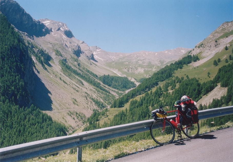
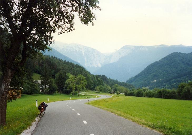
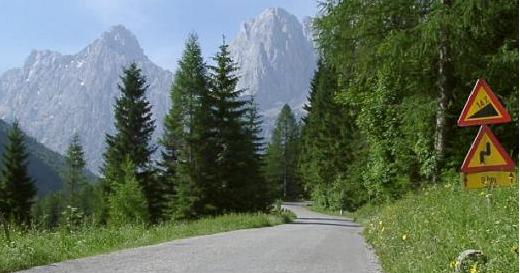
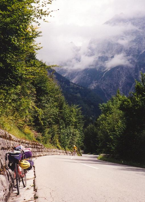
 On the slovenian side we have to cycle only 35kms to reach Kranj. On the 8% steep descent the bends are numbered and the heights are also shown on signs. Sometimes its worth stopping and enjoying the beauty of the land. After the first village, Zg. Jezersko the steep section ends, the cyclist has to push the pedals in the sometimes narrow, sometimes wide valley (photo). A stream follows the road.
Bicycling in the Julijske Alps + the Vrsic pass
- Kobarid Bovec Predel-pass Tarvisio (Italy) Kranjska Gora (SLO) Martuljek = 75 km + 1200 m heightdifference
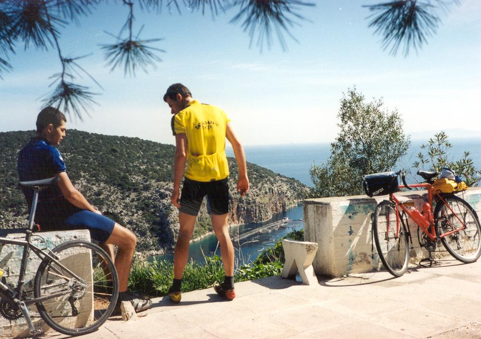
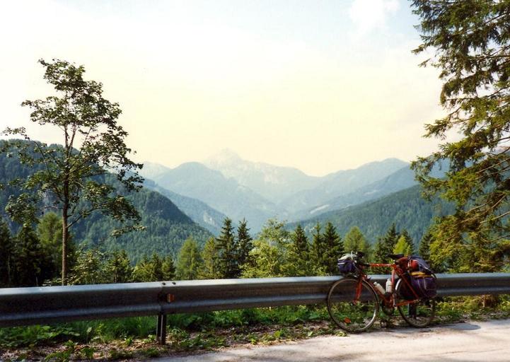
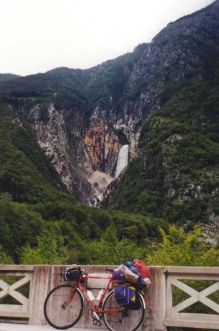
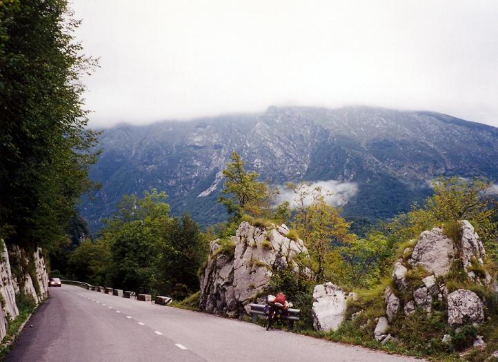
Kobarid is a friendly, calm town situated at the height of 235m, between high mountains. We leave its houses on a short, steep climb going between rocks. After this section cycling will be lighter to Zaga, as the road goes almost flat along the Soca river (photo). It is a nice part of the tour. In the narrow valley we meet a lot of plants, vegetation, and next to us the Soca river bubbles, which is known for the fights in the World War, but now it is famous for the rafting on the river. A few kilometers after Zaga if we look left we will see the huge Boka waterfall falling down from a high rockwall. Coming closer to Bovec the valley will be wider and we will get the sight of the foot of Vrsic passroad, surrounding by the 2600m high peaks of the Julijske Alps (photo). Bovec is a truly tourist-center. After the town we cant avoid to climb, if we want to go on cycling northwards. For bicycletourists I recommend to choose the Predel pass towards Italy, because it is lighter than climbing the 10-12% steep Vrsic and it is more logical to ascend the pass without a big pack, which can be left in the camp or motel.
 Cycling towards the 1150m high Predel pass the road to Log pod Mngartom (650m) is pleasant with its light steepness. Sometimes we meet short, steep hills. The mountains with the green, bubbling stream and with the fresh, green vegetation are fantastic. In Slovenia I enjoyed very much the atmosphere of the clear, bubbling streams. After leaving the village - which got its name from the mountain (Mngart) above it the cyclists have to climb only 7 kms, but the sign with the 12% steepness on it is an unpleasant surprise. I think the ascent somewhere may be such steep, but elsewhere it should be lighter. In every case in 1999 I climbed it with 20kg pack on the bike and with ranges of 42*28). From the ascent there are nice views to the mountains. Not much before the pass a narrow road goes off on the right side: the 12 km long road twists up under the peak of the 2677m high Mngart, to the heightest point of Slovenia (2072m), which can be reached on an asphalted road. However I havent cycled there, the 1000m heightdiference for the 10 km shows it should be a hard climb.
 On the italian side we arrive at the beautiful Predil lake after twisting down a few kilometers. Between the lake and the town, Treviso we can be rolling down in a gently sloping, wide, bare and not so nice valley. From the town which is famous for the leather-wares we can go back to Slovenia on a light ascent. In Kranjska Gora we get a beautiful view southwards, to the Julijske Alps and the valley of the Vrsic pass. I think it is worth spending there minimum two or three days (visiting the Vrsic-pass, Lake Bled and Bohinj). Camp(s) can be found in Martuljek (not far from Kranjska Gora and the Vrsic pass) or in Mojstrana or next to Bled. The campsite of Martuljek is orderly, it has a small shop. In 1999 I paid 1300SLT/night/person.
- Vrsic-pass there and back (from Martuljek) = 52 km + 1678 m heightdiff.
The 1611m high Vrsic pass is the heighest pass of Slovenia. Its beauty can be seen on the website http://www.cycling.uk.net/alps/east/vrsc.htm
 Leaving the tourist-center, Kranjska Gora on the almost flat road we can enjoy the view to the rocky, narrowing valley. We will meet a friendly lake at the end of the town. The lake and the center is connected by a walking path. Its interesting to experience the difference between the life and vegetation and atmosphere of the two sides.
 While the north side is colder, the road is followed by fir tree forests for long, and there are mosses on the trees, the south side is sunnier, warmer, there are more flowers and we can meet leafy forest in spite of fir tree forest. The hairpin-bends on the north side are build from cobblestones. I think it was done to avoid the accidents because of the slipperly roads. It is a nice surprise to read the height of each bend. Although it is not a light passroad, the 14% steepness on the sign at the feet of the climb is the maximum steepness. After the 3-4 kms with 8% steepness, we can cycle on light section for a while, but after the height of 1160m we have to hold on to the handle-bar; we dont have time to rest. I think the last 4 km can be 10% steep, somewhere with 14% sections. In this part the passroad goes totally under the high rockwalls of the 2547m high Prisojnik (photo).
 In the last kilometer we meet more and more parking cars and tourists along the road and we can see some path(e)s leaving to the peaks. If we have enough strength, I suggest to roll down and climb the Vrsic from southwards too. After 9km downhilling the steeper section ends at a bridge over a stream. From this 794m high point in the next 9km we have to climb 817m heightdifference, which means 9% average steepness. In this ascent the steepness is almost just the same from the feet to the top. There arent any 12-14% or 5% sections. After the heightness of 1300m looking ahead we can see the pass, the touristhouse and the whole valley (photo). It gives plus power to push the pedals. Rolling back to Kranjska Gora its worth turning carefully in the cobblestoned bends.
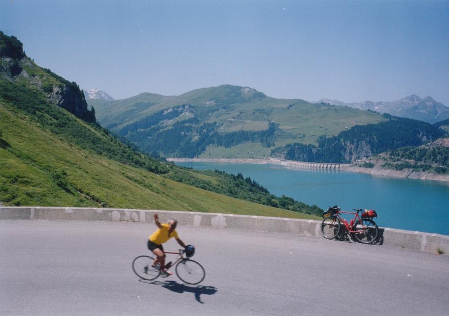
- Visiting Bled and Lake Bohinj (from Martuljek) = 132 km + 510 m heightdiff.
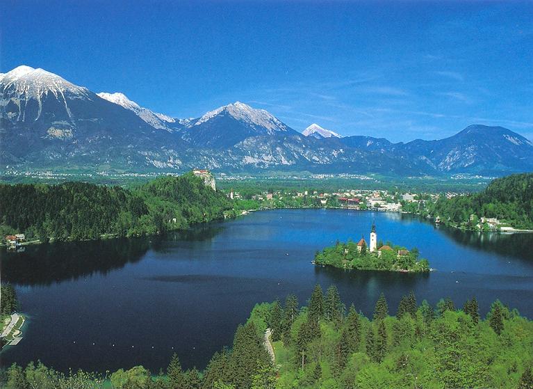
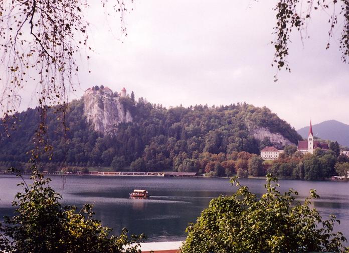
In this case its the same if we are in Ljubljana or cycling between the mountains of the Julijske Alps; we shoulnt skip to visit Bled, the gem of Slovenia. Bled is situated between 1000-2000 m high mountains on the shore of a beautiful Lake.(photos: http://home.t-online.de/home/ninoslav.andrasevic/galerie/g8-op-bl/bled-1.htm ). There is a castle (photo) on the rock next to the lake and a calm, atmospheric chapel in the island of the lake. The lake can be walked around in an hour. The island can be visited by rowing boat or gondola. From Martuljek to Bled the road is mainly lightly descending, which some flat parts. The industrial town, Jesenice remained in my mind because of its bad shaped, bumpy road (it was in 1999). Turning off from the main road - after a short downhill - on a short climb we had to use our muscles to arrive at Bled. Cycling towards Bohinj after a hill and 2-3km long slope the road goes along the river / stream Sava / Savinja between 1500m high mountains. At the Lake Bohinj we meet with tourists, shops, restaurants, but there are nice banks to sit and to enjoy the beauty. Staying on the bridge at the east side of the 6 km long lake we can enjoy the view of not only the lake itself, but the steep mountain-chain around too. On the right side (northwards from the lake) the rockwall is so steep and is so close to the lake that there is no place for a path there. At the end of the lake the rocks are steep too, but between the few trees a path could be led on the mountainside up to the Triglav valley starting in the plateau. Left from the lake a cable railway goes up to the 1500m high situated plateau of the peak Vogel, to the height of 1530m. On the plateau there are nice paths to take an excursion. Our backway will be familiar: almost flat road to Bled and then the gently ascending one and a half hour long cycling on the main road to Martuljek.
From Ljubljana to the croatian / slovenian / italian Adriatic
If we want to reach the Adriatic in a bicycletour, we can do it by bike of course, but if we have not much time its worth travelling by train. In 2003 from Hungary there were two lines towards the Adriatic: to Zagrab or to Ljubljana. From each city we should to cycle towards the Adriatic or use an other train (??). Its a fantastic feeling to catch sight of the Adriatic sea sitting in the saddle of a bike.
Cycling in Ljubljana: The capital of Slovenia has a lot of well built bicycleroads. Along the main roads the bikeroads are separated from the pedestrian path or pavement and it has bicycle-lamps at the crossings. A lot of people use bicycle to travel inside the city. Because the bicycleroads are in good condition and at the crossings ramps help the cyclists (so cyclists dont have to stop at the crossing if te lamp is green), bicycletravelling on bikeroads is not much slower than chosing biking on the mainroads next to the cars. In such a good bicycleroad-net its worth cycling there.
If we would like to reach the Adriatic by bike (from Ljubljana) we have three opportunities:
- Ljubljana Vrhnika Logatec Postojna Senozece Villa Opicina Triest (I) Portoroz (SLO)= 155 km (Biketours in 2000 and 1999)
We leave Ljubljana (298m) on orderly bikeroads going along the main roads. Between Ljubljana and Vrhnika (293m) a road goes next to the highway, this 15km section is almost boring. After the small town the climb - that goes to between the mountains - starts with some gently sloping bends. The 2-3 km long ascent is followed by a pleasant pleateu, but its sad to experience the bad surface of the road for a few kilometers: concrete-parts are taken beside each other. It is disappointing! After Logatec the road goes flat in the mountainside, there are only short light ascents, or descents. We go through a nice and calm countryside. Before Postojna the cyclists have to climb some kilometers, but the smell of the fir trees, flowers, the calmness and the sunshine hold a reward to the effort. It is a very pleasant, nice land. (This area reminded me of two slovakian roads: the first between Dedinky and the Grajnar-pass in the Slovensky Raj, the second between Tatralomnic and Strbske Pleso).
After Postojna (554m) we are pushing the pedals westwards in a 10-15 km long basin: A mountain with its shape and the TV-tower on it calls our attention to itself (photo). To the italian border the flat and sloping sections change each other (exception: the 5km long descent after Sezana). In the last kilometers we can feel the nearness of the sea. We cant see any mountains ahead, but looking northwards or southwards the mountains are only 400-700m high. In the italian bordervillage, Villa Opicina - where the road starts to descend to the sealevel - after a bend we can catch sight of the sea, and a monument is also there. On the middle-steep (4-6 %) slope we go down to Triest from the height of 316m. WE arrive at Triest on a 2*2 laned road. Triest is a big industrial town, except the center. I think stores, factories are settled down mainly because of the busy port. (Although in 1999 I arrived at Triest from the south a policemen stopped and told me not to cycle on mainroads and showed my where to cycle. Before this I coudnt find any other road towards from the south to the center.)
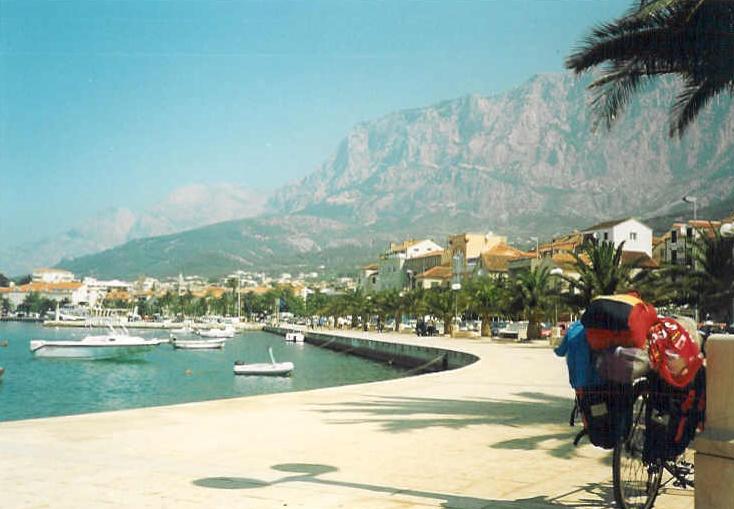
Arriving back at Slovenia the first town, Koper is also known for its port. Leaving the town its worth cycling on the bikepath along the busy main road and not on that. (Its not a problem for me to cycle on the road next to the cars, but that road was so busy that even I chose to cycle on the bicycleroad. The next place(s) where we should stop, have a rest, and look around is the last two slovenian villages, towns: Portoroz and Piran. In Portoroz (photo) a 2*2 laned road which is followed by palm trees, decorative lamps, flowers goes to between the hotels, the seashore and the beach I wrote it in 1999. At the end of the small peninsula, Piran is a calm, atmospheric village with friendly avenues and beaches.
- Ljubljana Vrhnika Logatec Postojna Pivka Illirska Bistrica Rupa (HR) Rijeka = 125 km (Tour in the year 2003)
Between Ljubljana and Postojna we choose the road about which I had written about in the last section. At the end of the town, Postojna that is famous for its dripstone-cave, if our destination is Rijeka we follows the signs / tables of Pivka or Illirska Bistrica. The middle of the summer (weekends or at the start of the holiday ?) is not a good period, because we can meet a huge traffic, that can spoil the experience of bicycling (it happened on 20, 21, june. 2003). To Pivka (570m) the flat or sometimes gently ascending road goes between small hills and mountains. After a 10 km long middle then gently sloping stream-valley we arrive at Ribnica, where from the flat or gently ascending road goes between meadows, hills and small mountains towards the border. From the croatian border (466m) we have to cycle only 17kms to the sea. On the second half of it we dont have to push the pedals because the road descends continuously. Arriving at the sea, southwards we can visit Rijeka and then cycle towards the croatians islands. If we turn right we can cycle around the Istria peninsula: we would fall in love with Istria on the gently ascending road to Lovran, because it is a long panoramic road with continuously views to the sea and some islands.
- Ljubljana Ribnica Kocevje Delnice (HR)- Lokve Rijeka = 143 km + 1550 m heightdifference (The tour in the year 2003)
We leave Ljubljana (with) following the signs Novo Mesto or Kocevje. After the junction at Skofjican the road will be hilly for 3 km long, but then it starts to climb continuously. The lands character will be more and more alpine: steep mountainsides with meadows, fir tree forests and somewhere houses alone.
 After ca. 5km climb we found ourselves on a plateau, then from Ortnek the road will descend gently along a stream. Coming out from the narrow valley, the valley of Ribnica is much wider. The mountains at the sides are about 1000-1200m high. The traffic is not too busy there; the flat road goes through small villages. Not too far after Kocevje but before the croatian border we reach the plateau of the mountain-chain with a 2,5 km long real climb. These mountains gives the same atmosphere as the mountains around Delnice (Gorski Kotar) will give in the croatian side. The whole land reminded me of the hungarian Bükk mountain-range: leafy forests, junipers, somewhere rocks, flowers and in both places the plateau can be visited on a good road-net. I enjoyed biking there, that was an ideal bike-region. Coming closer to Banjaloka (not Banja Luka) - looking through the trees - we can feel that next to the road on the left side there should be a deep, rocky valley. The road dances at the edge of the plateau / mountain. After Nova Sela we can look the valley, where to the road will descend in the next few kilometers. Its a great scenery: downwards the river Kolpa flows, opposite of us we can see steep mountainside with rockwalls and a fortress can be found too. We cross the river at the height of about 250-300m. In the croatian side we dont have opportunities where to go: there is only one way to cycle. We have to climb up to Delnice in spite of the 10% steepness. But its worth!
The climb reminded me of the slovakian forest-roads, where I so often enjoyed the calm nature, the smell of the fir tree forests, streams and the hardly trafficked roads. I met three times signs 10% steepness on them, so with my 24 kg weighted pack I needed the gears: 30*24 and 30*34.
After ca. 5km climb we found ourselves on a plateau, then from Ortnek the road will descend gently along a stream. Coming out from the narrow valley, the valley of Ribnica is much wider. The mountains at the sides are about 1000-1200m high. The traffic is not too busy there; the flat road goes through small villages. Not too far after Kocevje but before the croatian border we reach the plateau of the mountain-chain with a 2,5 km long real climb. These mountains gives the same atmosphere as the mountains around Delnice (Gorski Kotar) will give in the croatian side. The whole land reminded me of the hungarian Bükk mountain-range: leafy forests, junipers, somewhere rocks, flowers and in both places the plateau can be visited on a good road-net. I enjoyed biking there, that was an ideal bike-region. Coming closer to Banjaloka (not Banja Luka) - looking through the trees - we can feel that next to the road on the left side there should be a deep, rocky valley. The road dances at the edge of the plateau / mountain. After Nova Sela we can look the valley, where to the road will descend in the next few kilometers. Its a great scenery: downwards the river Kolpa flows, opposite of us we can see steep mountainside with rockwalls and a fortress can be found too. We cross the river at the height of about 250-300m. In the croatian side we dont have opportunities where to go: there is only one way to cycle. We have to climb up to Delnice in spite of the 10% steepness. But its worth!
The climb reminded me of the slovakian forest-roads, where I so often enjoyed the calm nature, the smell of the fir tree forests, streams and the hardly trafficked roads. I met three times signs 10% steepness on them, so with my 24 kg weighted pack I needed the gears: 30*24 and 30*34.
Delnice (698m) is surrounded by 1200m high romantic, rocky mountains; the town can be a good start for nice excursions. After an 5 kilometer long, hilly section we arrive at the turn off to the Lake Lokve (I gave this name to the lake from the village near to it.) With a 6 km long detour we can visit the lake, which we will see from the mountainside, 100m higher. The mountains of the Risnjak National Park can be seen behind the lake. On the main road the cyclist have to climb 2,5 km on a middle steep (4-5%) ascent to reach the parking place with the panorama (photo).
Afterwards the road goes through a hilly area at the height of about 7-800m, until we arrive at the 881m high situated Gornje Jelenje pass, which gives a beautiful scenery to the sea. (It is better in the morning than in the afternoon.) From the saddle its worth rolling down only 200m southwards (towards Krk) to get that view. The east shore of the Istria peninsula, and Cres and Krk islands can be seen well. Choosing the slope towards Rijeka we can enjoy a middle steep 11 km long descent to the airports flat and dry meadow. In the middle of the slope we can experience a sharp change in the vegetation. In the upper part the plants are green and full of life, in the lower part they are dry and yellow. After a few kilometer flat cycling and crossing the highway the road starts to descend again. Before arriving at the sea, the road goes through a short canyon, which through as we would watch a film we can get sight of some tower blocks and a viaduct of Rijeka with the sea behind them.
Via Slovenia
In the course of my tours, I crossed Slovenia in three different ways. Because in the south part of the country there is no east west going road, and cycling on highways is forbidden, there are only four ways to cross Slovenia by bike. In the following I will present three of them. (In the paragraphs above I have written about the roads between Ljubljana and the Adriatic sea, so I wont repeat them.)
- Along the river Drava to Austria (it was mentioned before)
- On flat roads, along rivers towards Hungary: Ljubljana Litija Hrastnik Lasko Celje Rogaska Slatina Lepoglava (HR) Varazdin (HR) = 138 km SZINT (to the croatian border). Bicycled in the year 2000.
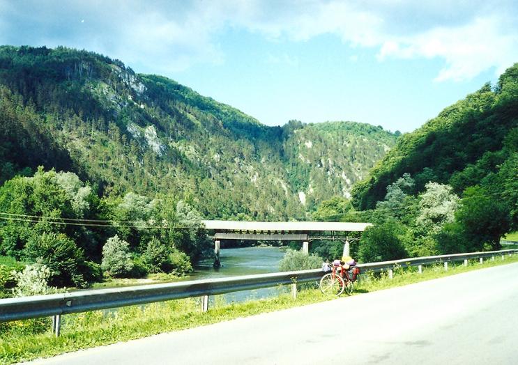
Although cycling in forbidden (there was minimum one sign about it) in the first section of this route (to Litija, its sure) , if we want to reach Hungary in a short time, this is the best route. On the very good conditioned, paved road we can cycle to Zagorje 54 flat kilometers. The road allows us to reach a good speed. The road goes, twists between 700-900m high mountains, along the river Sava. In Litija we will meet the Sava tyre factory. Standing on the bridge, we can get a friendly panorama both ahead or backwards. In the following the valley became narrower and more romantic: the steep mountainsides are more and more rocky. (photo)
 On the 10 km long section between the turn-off to Zagorje and to Hrastnik the natural character of the land are ruined by often appeared lorries, factories and a hydroelectric power plant. After Hrastnik in order to going on cycling in the valley of the river Savinja we had to climb through a little, but steep mountain. The first, two kilometer long part of the ascent is pleasant, but after the last houses of the village / small town it turns to east with a steep bend. After the next middle steep section in Brdce we get a bad surprise: the last 1-1,5 km is about 8-10% steep. On the following short downhill we reach the river Savinja, where we can push the pedals northwards, to Celje. On the way we will meet a very nice and
:-)
friendly, orderly, flower-decorated town, Lasko which is famous about its beer factory. The first thing that the biker will see about/from Celje, that is the fortress on the top of a hill. After turning eastwards in the town (241m) the area becomes hilly and more pleasant, but the road remains flat for a while. It wont change to the croatian border. There are low hill-ranges on both sides of the road, we will meet friendly villages, and the road is followed by a railway. After Sentjur - where the valley of the Vogljana-stream ends it can be met more and more often 0,5 1 km long climbs and slopes. After Rogatec we will arrive at the croatian border again along the railway. In Croatia if we want to visit Hungary - I suggest to choose the road towards Lepoglava. On that way the hungarian border (Letenye) can be reached in about 100 km. In Croatia, after 7 km we arrive at the junction, where we have to turn off to Lepoglava. For me it took a quarter an hour to find the right way. The road to Lepoglava didnt give me pleasure in 2000, because somewhere it was under construction, elsewhere its surface wasnt too good. On the gently sloping or flat main road I could go faster at last. After Varazdin the road towards Hungary cant be missed.
On the 10 km long section between the turn-off to Zagorje and to Hrastnik the natural character of the land are ruined by often appeared lorries, factories and a hydroelectric power plant. After Hrastnik in order to going on cycling in the valley of the river Savinja we had to climb through a little, but steep mountain. The first, two kilometer long part of the ascent is pleasant, but after the last houses of the village / small town it turns to east with a steep bend. After the next middle steep section in Brdce we get a bad surprise: the last 1-1,5 km is about 8-10% steep. On the following short downhill we reach the river Savinja, where we can push the pedals northwards, to Celje. On the way we will meet a very nice and
:-)
friendly, orderly, flower-decorated town, Lasko which is famous about its beer factory. The first thing that the biker will see about/from Celje, that is the fortress on the top of a hill. After turning eastwards in the town (241m) the area becomes hilly and more pleasant, but the road remains flat for a while. It wont change to the croatian border. There are low hill-ranges on both sides of the road, we will meet friendly villages, and the road is followed by a railway. After Sentjur - where the valley of the Vogljana-stream ends it can be met more and more often 0,5 1 km long climbs and slopes. After Rogatec we will arrive at the croatian border again along the railway. In Croatia if we want to visit Hungary - I suggest to choose the road towards Lepoglava. On that way the hungarian border (Letenye) can be reached in about 100 km. In Croatia, after 7 km we arrive at the junction, where we have to turn off to Lepoglava. For me it took a quarter an hour to find the right way. The road to Lepoglava didnt give me pleasure in 2000, because somewhere it was under construction, elsewhere its surface wasnt too good. On the gently sloping or flat main road I could go faster at last. After Varazdin the road towards Hungary cant be missed.
- Kranj Kamnik Stahovica Radmirje (Logarska dolina: Radmirjétől to and back 68 km) Nazarje Velenje Dravograd (from where we can go to Austria or after turning east cycling along the river Drava) = 124 km (without Logarska dolina)
 The route unfortunately this was not the first in Slovenia starts with searching the right road. In 1999 I followed the signs Kamnik and Airport and at last I found myself nearly on the highway, so I had to ask people where to find the road towards Kamnik. The 8 km long road towards the airport is very lightly sloping, so here the cyclist can enjoy the good speed. It was pleasant as in the flat area between Kranj and Kamnik I was coming closer to the Kaminské Alps and going away from Julijské Alps. I felt, that the mountains which are situated north from Kamnik werent similar to the others in that area; it was taken with me. There is two road to choose towards Dravograd, but its worth visiting the Logarska valley, one of the diamond of Slovenia, because of this I suggest to choose the northwards situated road through Stahovica and Gornji Grad. From the village, Stahovica which is next to Kamnik we can take a 8+8 km long detour close to the 2558m high Grintavec mountain. The eastwards going valley ascends lightly between mountains which are only 2-300m higher than the valley itself. It is a friendly area: there are small villages, farms here and there. There is no steep section during the climb, on which we rise to the 902 high Crnivec pass. We meet the first sharp bends only a few kilometers before the saddle. In 1999, when I caught sight of the sign with the steepness of the descent at the top, I smiled: the 10% meant that I chose the right side to climb. On the east side of the pass the country are open: the mountainsides are not soo steep, and there are meadows here. After 6 kilometer long steep descent the road become less steep, where the catherdal of Gornji Grad is worth visiting. In Radmirje the road goes into the road that comes from the Logarska valley and goes away to Mozirje.
Detour to the Logarska-valley:
:
In the Logarska valley cycling starts on flat or gently ascending road along the stream. After about 5 km the valley turns narrower, and the road itself is narrow too, but I remember as if in 1999 it was under widening. The stream bubbles wilder and wilder.
 Leaving Luce the road continues its light ascending (it is ideal for hobbycyclers), sometimes it crosses the stream on wooden-bridges, and goes through a canyon. As the valley turns wider, we can catch sight of a high and graceful churchtower of the Solcava (680m) in front of the ffir tree covered, rocky mountains. Thats the way how the village welcome us. Although we cycling between 2000m high mountains in vain, the road ascends very gently. After the canyon the valley turn wider and behind the meadow we can see a very beautiful mountainwreath. This picture often appears in slovenian travel prospectuses: the green meadow, fir tree forests and the 2300-2500m high mountais with a little snow on them. Enjoying this view for me it wouldnt had been a problem to pay for the entrance to the forestroad, but to enter the area was free for bikers, and even I got an information-prospectus about cycling and hiking there.
I cycled 7 kms to between the rocky mountains; I think it couldnt go too far then, because the mountains were close enough. The first kilometers were flat, then after 2-3 kilometer long middle steep climb I turned back at the Planicev tourist-house (on that day in 1999 I had to cycle a lot).
Leaving Luce the road continues its light ascending (it is ideal for hobbycyclers), sometimes it crosses the stream on wooden-bridges, and goes through a canyon. As the valley turns wider, we can catch sight of a high and graceful churchtower of the Solcava (680m) in front of the ffir tree covered, rocky mountains. Thats the way how the village welcome us. Although we cycling between 2000m high mountains in vain, the road ascends very gently. After the canyon the valley turn wider and behind the meadow we can see a very beautiful mountainwreath. This picture often appears in slovenian travel prospectuses: the green meadow, fir tree forests and the 2300-2500m high mountais with a little snow on them. Enjoying this view for me it wouldnt had been a problem to pay for the entrance to the forestroad, but to enter the area was free for bikers, and even I got an information-prospectus about cycling and hiking there.
I cycled 7 kms to between the rocky mountains; I think it couldnt go too far then, because the mountains were close enough. The first kilometers were flat, then after 2-3 kilometer long middle steep climb I turned back at the Planicev tourist-house (on that day in 1999 I had to cycle a lot).
Between Radmirje and Mozirje the road is flat, and fast. 2 kms after the town we should turn off towards Velenje. With it a middle hard climb waits for the travellers, in order to rolling down to Velenje afterwards the town from there the Gorenje fridge came from. The road leaves Velenje in the gently ascending valley of the Paka stream. After 11 light kilometers the climb finishes with a 2 km long 8% steep section. From the saddle, Mislinja the cyclers only have to follow the road; it rolls down to Dravograd without any climb. (From Dravograd the route can be continued to Austria or along the Drava river inside Slovenia, as I have written about it.)
Györgyi Gábor
Stat: