Györgyi Gábor: Bicycle tours in the French Alps - indulging in nostalgia (2nd part)
GÁBOR GYÖRGYI
Nostalgic bicycle tour in the French Alps and collecting paved roads going above 2000 m
10-22nd June, 2011. (13 days): 1530 km + 28989 m height difference (2nd part)
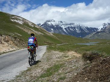
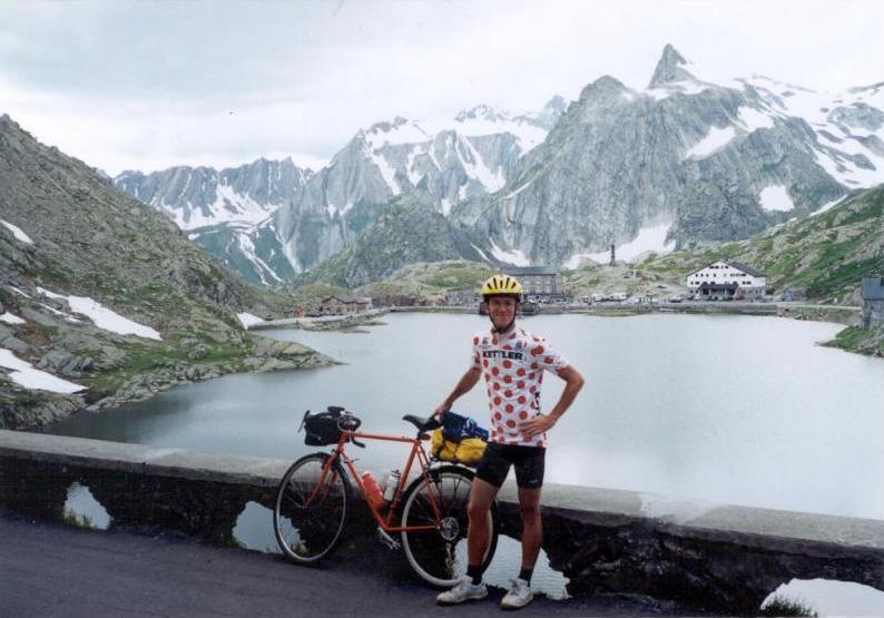
18th June, 2011 – 8th touring day: Briancon – Col du Lautaret (2058 m) – le Bourg d’Oisans – Alpe d’Huez - Lac Besson (2080 m) – Le Bourg d’Oisans = 113,2 km + 2324 m szint (3156 kcal)
I woke up for a rainy morning and had to break the camp by rain. I let the time passing by for a while, but before 12 am. I had to leave Briancon to be able to pass the Col du Lautaret (2058 m) not too late to remain enough choice to climb this day to Lac Besson (2080 m), which is situated above Alpe d’Huez. I was facing with the rain, the grey clouds and in the last 6 kms the facewind. Twice I stopped for 10-30 minutes at a bus stop, but because I didn’t want my long sleeved jerseys to get wet, I wore only a short sleeved jersey and the rainjacket, that’s why I didn’t spend too much time by the bus stops.
The daily returning rain annoyed me, but I tried to think about the hope of the better weather for the afternoon. I hoped it was only a question of time. At last the wind started to blow stronger and blow in my face, so I hoped that it was the end of the weather front. I was determined, the rain couldn’t stop me in reaching my aim. Sometimes I felt more than only cycling up to hardly known ascents, but the thing that „my task"- as a cyclotourer from a non alpine country, Hungary - is to spread the information, to inform the cyclists about those not known climbs with my travelogues, pictures and videos (these climbs for example: Parking du Laus, Plan du Lac, Plan d’Aval, Alpage Mandelon, Cheneil (will be uploaded in Febr, 2012) etc. - that I added to the quaeldich.de and salite.ch database too.) I reached the Col du Lautaret (2058 m) by awful weather: in rain, fog and cold wind. I put on warm clothes by the restaurant and started the descent with the hope of the arrival of scattered clouds and sunshine.
After few kilometers I stopped at La Grave, by the tourist office to check that La Chazelet ascent wasn’t paved and by this time I enjoyed the pleasant temperature in the house. After another half an hour long cycling I came out of the rain, and as I cycled under scattered clouds, I could take off my rainclothes. During setting up my tent under the sunshine, my body could slowly warm up itself. After buying some food I started to climb Alpe d’Huez to reach my higher target,
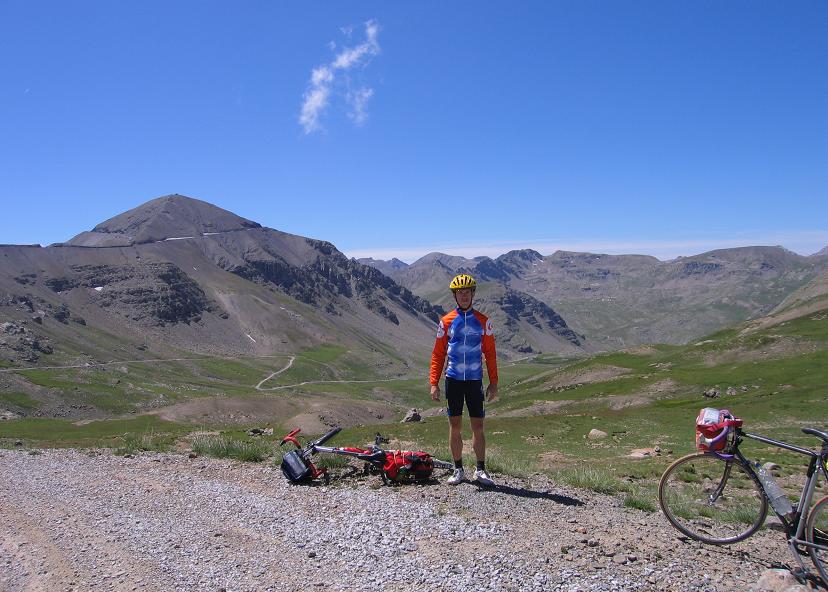
Lac Besson (2080 m), another climb which end is situated above 2000 m, and I hadn’t visited before. In the year 2004 I had cycled to the 1999 m high situated Col de Poutran, but than I hadn’t know about the lake and hadn’t been keen on collecting not only cols, but ascents finishing above 2000 m. In 2011 that was another occasion, when I cycled up more than 1100m heightdifference extra, just to cycle further 2-3 kms and 80 m heightdifference. I did similar ones, later in the summer, when I visited Dosso Galli because of the
lack of 1 km ascent or cycled 2 times Splügenpass because of Lai da Vons ascent (6kms) or cycled totally 2400m heightdifference on the ascents of Passo di Gavia so to ride up on the 5 kms long ascent of Rifugio Forni (2176 m).
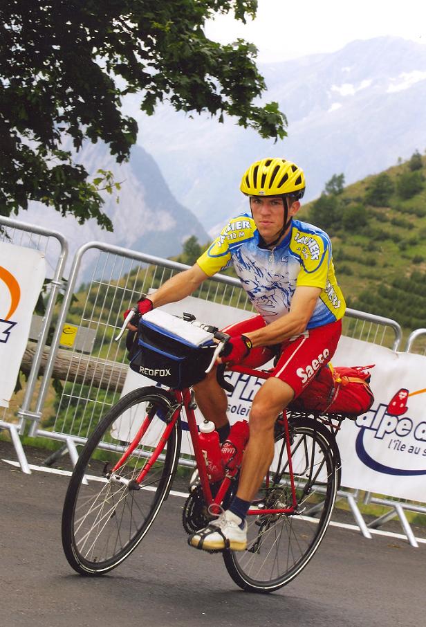
Alpe d’Huez climb was great again: I recorded moody videos, for example when I cycled and chatted ca. 1,5 kms long with belgian cyclists. I was surprised by the dozens of cyclists there already in June.
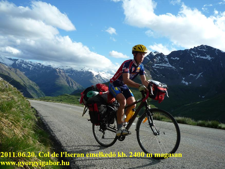
After my visit at Alpe d’Huez in 2004 (2), 2006, 2009 (2: the last by the finish of La Marmotte) that was the 6th times that I climbed the hairpin bends of this famous ascent, so I didn’t got too much surprises, but instead of that I enjoyed returning back and indulging in nostalgia. By the wide road at the finish I spent enough time with taking photos and video, so I reached the 2080 m high situated Lac Besson at sunset. On the descent sometimes I let the bike go fast and enjoyed the speed, at another time I used my videocamera for recording the descent. I arrived at the camping just in darkness.
Video & map about the "Col du Lautaret & Lac Besson" day
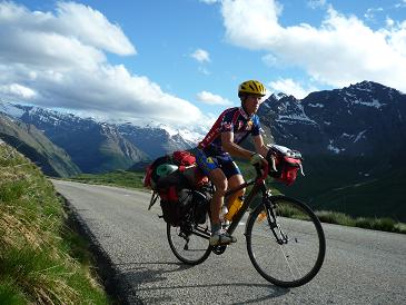
19th June, 2011 – 9th touring day: Le Bourg d’Oisans – Col du Lautaret (2058 m) – Col du Galibier (2645 m) – Valloire – St Michael du Maurienne – Modane (1063 m) – Aussois – turning „point" between Plan d’Aval and Plan d’Amont at 2010 meter – Modane = 134,7 km + 3461 m heightdifference (4041 kcal)
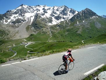
The second key day of my tour started in Bourg d’Oisans by bright sunshine. The daily program was cycling up to Col du Lautaret (2058 m) and returning to the legendary Col du Galibier (2645 m) on its southern side, where I had already cycled it in the year 2004. In the evening I planned to cycle the hardly known ascent to Plan d’Aval. I ascended the Lautaret by wonderful weather with enjoying the views of the snowy, rocky peaks of the nearly 4000m high La Meije. Through the climb I met with ca. two dozens of cyclists. Not much before as a cyclist on a racebicycle overcame me, he expressed his appreciation to me because of cycling with carrying so heavy panniers: „-Respect!".
I was glad to hear this: on such a long alpine tour I rarely met with bicycletourers with heavy panniers: maximum one a day was the average. By the saddle the weather was just the opposite than on the previous day, but not too warm and a little bit windy. As I was eating some food to get energy for the following hours I saw few people of the SKY professional cycling team’s stuff, cars, truck, racebikes and one or two cyclists. I think one of them was Juan Antonio Flecha; he was speaking spanish. In June Alberto Contador and Ivan Basso were training there too.
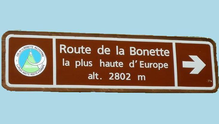
I was looking forward to cycling Col du Galibier again, because – after cycling nearly 20.000 kms in the Alps I could say Galibier should be considered as one of the most beautiful ascents / cols of the Alps between such climbs, than Col de l’Iseran, Colle Nivolet, La Bonette or Plan du Lac).
The great expectations weren’t fulfilled on the first 2-3 kilometers, because the too serious traffic didn’t let me enjoy the twisty and panoramic road. I was angry with the traffic. Above ca. 2000-2300 meters high I could enjoy it more and more, so I didn’t hurry, didn’t look at my watch but I paid attention to enjoy every minutes of the wonderful ascent. I was happy to stop at the same „kilometer-sign", where I had taken maybe the best photo of my tour in 2004. In the year 2011 I repeated it, but made video too.
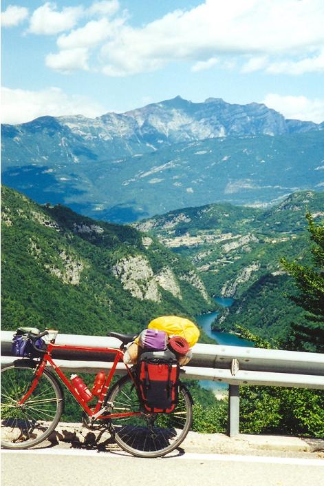
I had to put on enough warm clothes and my cap for the descent. In the morning I fixed my shoes onto my panniers to dry through the day, but the pavement wasn’t good enough, so because the fixing wasn’t tight enough, after a while I realized that I lost one of my shoes from there. I had only one pair left, so I had to be careful with cycling in the rain, although I had cover onto them. After setting up my tent in Modane, at ca. 7 pm. I started the hardly known ascent towards Plan d’Aval (1950 m) and Plan d’Amont (2050 m), two mountain lakes. The climb remains memorable because of the cold. To the half of the length, to Aussois (at ca. 1500 m) it was a panoramic road with nice views down to the valley and to the southern, snowy mountains. At Aussois I measured 12 degrees Celsius. After the village the road became steeper and twisted and turned around and under the cable-car line, sometimes giving views to the village and to the mountains.
The paved ascent ended at a sharp corner, just above the Plan d’Aval lake and barrage with a parking place there (at ca. 1988 m). Of course I cycled further, but at ca. 1995-2000m the pavement was changed for dirt road, so not much after it, I turned back. At the parking place it was almost darkness, when I put on my warm clothes (with socks and warm cap) for the descent. As I remember, I didn’t carried raintrousers with me, so with a leg-warmer the descent was fairly cold. I checked the data after I arrived at the camping and I realized, that by the lake it was 4 degrees Celsius. I had another great day, when I kept on with my „good habits": I fulfilled my aims of cycling up to the planned ascents finishing above 2000 m. That day I cycled 135 kms + 3461 m heightdifference. A similarly hard day waited for me.
Videos of the day with Col du Galibier & Plan d'Aval
1st part:
2nd part:
20th June, 2011 – 10th toruing day: Modane – Termignon - Plan du Lac (2361 m) – Lanslebourg – Col de l’Iseran (2770 m) – Le Saut (2240 m) – Tignes (2100 m) – Bourg St Maurice = 161,9 km + 3890 m heightdifference (4578 kcal)
I woke up for the most motivating day of the tour; I was looking forward to it: I considered the day as the „king stage" of the bicycle tour. „King stage" is used for those stages of the serious, minimum week long bicycleraces (Tour de France, Giro d’Italia, Vuelta a’ Espagna, Tour de Suisse) which are the hardest or nearly hardest but have very legendary, prestigious climbs or summit finishes. I planned to cycle 4 times above 2000 m, one of them, the highest col of the Alps, the 2770 m high Col de l’Iseran.
In the first hour of cycling I could see the mountainside of Plan d’Aval by sunshine, where I ascended last evening. Not far away a similar climb waited for me: another low trafficked mountain road to a high situated lake, saddle: Plan du Lac (2362 m). About this ascent there was no cycling info on the internet, and that motivated me to be the first to do that: to inform the cyclists about it with a travelogue and my video (later, after my video, Jerry Nilson, the great cyclist also visited it).
Based on the 1 or 2 info about the ascent I knew that it would end by a parking place at 2308 m. Just as I left the main road after Termignon I tried to find a proper place to hide my panniers and I could do it inside a kilometer. Few kilometers later, with about 10-11% steepness in the forest, the road let more and more views to the mountains, fir-tree forests, meadows, rocks, small waterfalls and back to the valley. I was cycling in the Vanoise National Park. The landscape amazed me and I could enjoy it very much, because there was no traffic. With more than 20000 kms cycling in the Alps I can say: for me it is between the 10 most beautiful ascents of the Alps (others are for example: Col de l’Iseran, Bonette, Colle Nivolet, Passo Stelvio, Mannlichen, Alpe Galm, Bettmeralp, Col du Galibier, etc.)
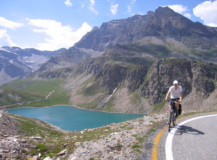
Arriving at the Bellecombe parking place (2308 m) I experienced with surprise that the cars weren’t let go further, but the paved road went higher. I kept on cycling above and after ca. 1 km I reached the saddle (2362 m), the road became flat and after a little bit descending I could see the other side of the mountain: the lake and the 3855 m high, snowy mountain behind it: Ponte de la Grande Casse. After taking enough photos and recording videos I turned back.
I kept on cycling in the Arc valley carrying my panniers again, and returned back to the lovely Lanslevillard and then the beautiful, calm valley with waterfalls, grassy mountainsides. From Bonneval the 13 kms long and 7% average steep part of Col d’Iseran started. As I got used to it, there were signs to the cyclists by each kilometer with the height, the steepness of the following kilometer and the remaining distance to the saddle.
Nevertheless I had this informations from the profile / diagram lying on the top of my frong handlebar-bag.
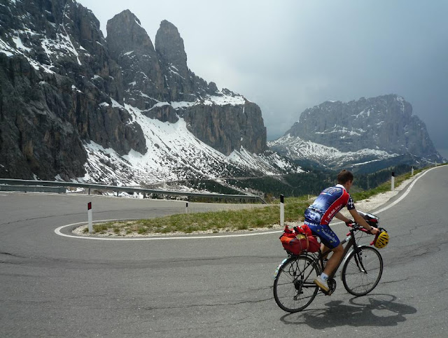
Cycling on the serpentines, the ascent I was indulging in nostalia again: reaching the level of 2000 m I remembered the year 2004, when I realized darking clouds, then I had to cycle in rain and cold on the last few kilometers, but after waiting a little at the col de l’Iseran I enjoyed wonderful scenery on the descent. In 2011, on that day the nice weather didn’t change, but after cycling through the gorge, narrow rockwalls I got serious facewind I had to face within the last 3 kilometers with 9-10% steepness.
So in the last 3 kilometers I needed serious efforts to reach the col, but I could enjoy a marmotte by a short stop. Because of the last half an hour efforts, when I arrived at the top and rolled through the „finish line" with a „Cima Coppi" sign, it wasn’t surprise that I shouted into the air (as the famous hungarian poet, Mihály Vörösmarty wrote): „-It was great joy, man’s work" - and not on a 8-9 kg weighted bicycle, because that’s an other story. That was the 3rd times that I rode my bicycle up to Col de l’Iseran and each time I carried 25-26 kg weighted panniers. I haven’t ever cycled Col de l’Iseran without heavy packs.
I enjoyed the descent very much and with the videofilm that I recorded I try to show the feeling and the nature to the curious people. After winter this mountain road is usually opened for the traffic by the middle of june, so I was surprised that even on the North side of it there wasn’t too much snow, I couldn’t see snowwalls. I didn’t see much more snow than in July, when I last cycled there. After cycling through Val d’Isere and hiding my packs by the shore of the Lac du Chevril I had 2 shorter ascents yet for the evening. A narrow pavement twisted and turned upwards on the panoramic mountainside to Le Saut (2280 m). To the half of it the road offered great views to the lake and the lighted villages by or above the lake. I could see Tignes, the end of my following climb. Inside the last kilometer I had to turn on my lights. I reached the parking place by the end of the pavement at 10:20 pm. Before turning back I thought that I had to be careful because of the small, sharp rocks on the road, but I wasn’t careful enough and my lights were old enough not to catch sight of a sharp stone which made my front tyre be flat after its voice.
I left my spare tube in my hided packs, so I had to repair the inner tube using my front lights: it was weird, strange: repairing my inner tube at the height of ca. 2000 m, by darkness and using my lights. After another repairing by the packs I reached Tignes (2093 m) at 1 am.! It was night, but I was motivated and it was a must too!
I had one day left before flying back to Hungary and I had to climb Courchevel in the morning and Col du Petit St Bernard in the evening. I wasn’t angry, cycling by darkness didn’t cause a problem for me with no traffic on the road and with my lights with new batteries in it. On the following day I had only Courchevel (2000-2030 m) to reach the level of having cycled all of the paved roads of France going above 2000m.
Videos of the day with Plan du Lac, Col de l'Iseran, Le Saut, Tignes
1st part:
2nd part:
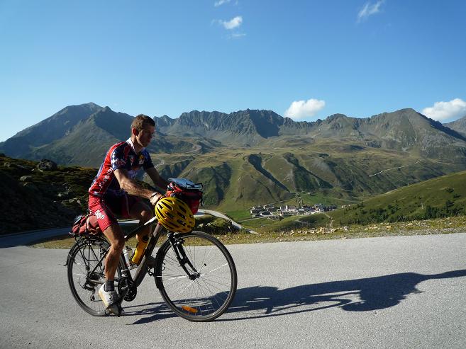
21th June, 2011 – 11th day: Bourg St Maurice – Moutiers (500 m) – Courchevel, airport (2050 m) – Moutiers – VONAT – Bourg St Maurice – Col du Petit St Bernard (2188 m) – Morgex – Avise = 160,7 km + 3100 m heightdifference (3574 kcal)
After ca. 6 hours sleeping after my hardest day, sunlights made me wake up. After the „king’s stage" it wasn’t a surprise that I felt not so fresh and didn’t feel myself full of energy, than earlier. Because of this I prepared myself for the day, I thought: „-Just to get over it, be after it: it isn’t important, how – tired or slowly or worn-out – but I will cycle it trough!" – I was sure.
Because earlier (in the year 2009) I had cycled in the valley, I wanted to travel by train to Moutiers, but because of the trains followed each other rarely, I had to cycle. That also didn’t help my day, but partly is was a descending valley so it didn’t cause too much effort. Courchevel is a serious ski-center in France and hosted Tour de France and was stage finish of the Tour de France, in 1997, when Jan Ullrich and Richard Virenque was fighting with each other during the ascent. At the end Ulle let Virenque win (as he told it), because he deserved it, Richard fought very much.
Cycling through and after Moutiers I was indulging in nostalgia for a while, but after leaving Brides les Bains behind, there was not too much to enjoy: sometimes the ascent was nice and gave views to the mountains but the too much traffic, the many trucks, lorries blocked enjoying cycling. By the junction that turned directly to Courchevel, there were two signs for the cyclists: they were about challenges for cyclists: the www.savoie-mont-blanc.com/nos-suggestions/bouger/activites-velo/chronometrage-timtoo-1275-1.html seemed to be an individual time trial on ca. 40 ascents of the Savoie – Mont Blanc region measured by the cyclists, the other Cyclocourch )seemed to be races on every weekend.
Courchevel is a ski-center town consisting of 3-4 parts which names shows their heights, like: Courchevel 1550, Courchevel 1600, Courchevel 1850). By Courchevel 1550 as I saw the serious constructing work, I hoped the truck-traffic will decrease after leaving it behind. As I was ascending higher and higher the traffic didn’t change. In Courchevel 1850 I saw nice and good-looking appartman-houses and trucks too. When I arrived at the bottom of the Courchevel Altiport I saw there trucks and constructing too: because of the lot of construsting area I thought, there was no recession here!
The last constructing area I left at ca. 1950 m, then I cycled to the altiport building and then onto the last short, steep climb above the altiport, to 2030 m high. The paved road finished there. Reaching that point, which was the 188th occasion that I cycled above 2000 m, I completed the collection of the french paved ascents finishing above 2000m. I cycled all of them (the climbs in the Pyrenées I completed in the year 2010).
From Moutiers I travelled back to Bourg St Maurice, where to I had already cycled in 2009. After I quickly broke my tent I began cycling up to Col de Petit St Bernard (2188 m) at ca. 7 pm. Although the french side’s heightdifference is 1300 m, this ascent is an ideal climb for finishing a bicycletour, because even it’s long, but not stoo steep. At the lower section I enjoyed the views to the valley towards such climbs (La Plagne, Les Arcs 2000, Col de l’Iseran valley) where I cycled before, then later I pushed the pedals in forest and then when the clouds started darkening, they made me sad and angry. The clouds’ movement made me understand that I have no choice of escaping, but I tried it. It was interesting to experience, that after the previous hard day, then cycling Courchevel in the morning I was able to do a 20 minutes long „time-trail" with carrying 26 kg panniers on my bicycle. I used my muscles and all of my energy. I knew that there are not too many shelters along this climb and I could’t escape. It started raining before I could reach the following one, so I quickly looked for trees as shelter.
As nightfall arrived I had to keep on cycling and fortunately the rain was over. Under clear sky, but looking the lights and hearing the voices of thunders I reached the Col du Petit St Bernard at half past 11 pm. Then I descended carefully to Aosta valley on the wet and twisty road. My airplane was to take off in the following afternoon, so I kept on cycling in the valley to be closer to Aosta, where I planned to catch the train in the following morning. When I set up my tent it started raining again not to cause another surprise for me. I went to sleep at ca. 3 am, so I have ca. 4 hours for sleeping.
Video & profile about the "Courchevel c Col du Petit St Bernard" day
22th June, 2011 – 12th day: What a closing day !
At 3 am. I went to sleep with the thoughts that if the malediction keep on effecting my tour, or with other words: if the row of the affairs keep on existing to make my tour more difficult, than I would have to break my tent in rain. Unfortunately it seemed to be I would be right, because I woke up for rain, but it was stopped by a miracle / wonder for the time of breaking my tent. Leaving the camp towards Aosta it was raining again.
I changed the train at Chivasso, where I had a little time for looking around the town. During this, despite of the better weather it started raining again, so when I phoned my parents, I told them: „Do you miss the rain in Hungary ? Don’t worry, the rain follows me, I will bring the rain with me!"
I thought I could cycle by dry weather through the great plain of Milano / Po to the airport, but it didn’t happened this ways. First I cycled in sweaty, humid weather, sometimes in light rain which stopped me for putting on raincoat after a time. But that wasn’t enough! More things were needed to be against me! (In the year 2004 I thought the same: everything was against me)
I think I didn’t understood a sign well (airport and cargo words next to each other), so I cycled ca. 10 minutes, when I realized, I’m on a detour. After I asked for help I cycled another 5-8 minutes faster and faster, but then I had to ask for halp again and again. It was annoying to hear that I had to cycle another ca. 5 kms to the airport. After a time I didn’t know where I cycle (I cycled out from my not enough detailled map). By that time I was hurrying at 27-29 km/h and I was at the edge of panicking, that I would miss my airplane. Previous day I thought, that I had finished the tour with success and the last day couldn’t be a problem. Then it seemed that I could fall just before the finish line. What a situation to miss the airplane at the surroundings of the airport, after searching it for little bit more than an hour long?
At last I managed to find a village sign that I saw on my map, so I could reach the airport not too late. At the airport I ran to get the information if I had to check in there, then I quickly prepared my bicycle for the flight: I had max. 30 minutes for it instead of the one and a half hour. After the rain and sweat, I tried, but I had not too much time to clean myself, so I only changed my clothes.
Fortunately I could catch the airplane : what a tour-finish it was! Earlier I thought I would have trouble free travel back to home, but instead of that I was within an ace of missing my airplane.
By my earlier bicycle tours I often experienced difficulties which I had to accept, but then I could accept them beside of the success. After this tour the feeling wasn’t the same: there weren’t any difficulties that could stop me or could make me renounce something. I didn’t have to renounce any climbs, so it was strange that I could defeat all of the problems. I couldn’t understand how I could be stronger than all of the difficulties and attempts against me? But I felt, everything was tried against me, but I could solve the problems, go over the difficulties for reaching the success.
Closing words / Afterword / Epilogue:
An interesting experience of my bicycle tour was that in the middle of June the mornings could be cold, but in daytime the temperature was pleasant. It can be nice cycling weather but I suggest to put on enough clothes (even cap!) for the descents, specially in the evening. Considering the rain, during the 11 days I had 14 times rain and I only had 2 days, when I had no rain. This weather wasn’t similar that I experienced during my previous tours, although those tours I cycled or started mainly in July. BUT!... I have to say, after my following tour in Switzerland and Italy (2358 km + 49663 m heightdifference) in the 2nd half of July, I can say: If I had the same weather than in France, I would have been satisfied and happy, because in those countries I had even worse and colder weather.
I was surprised that already in June how many cyclists have ridden their bike sin the French Alps. If the reader is fed up with the trafficked cols, mountain roads, I can suggest visiting Plan du Lac, Plan d’Aval, Chalet du Lacal or for example Col de Granon or Col des Gondrans, where nothing disturbs enjoying the nature and landscape.
After the little bit rainy, but successful bicycle tour (during the 11 cycling days 1380 km + 28.769 m heightdifference), which offered me wonderful weather on the key days (Bonette, Galibier, Iseran), I planned to cycle my following tour in the swiss and italian Alps with fulfilling my dream to cycled all of the paved ascents above 2000 m in the Alps too. After the same in the Pyrenées in the year 2010, the performance by the Ötztaler radmarathon, and managing to cycle the Galerien version of the Club des Cingles du Mont Ventoux challenge, that (complete alpine collection of 2000+ paved roads) meant the last really cycling challenge for me.
Looking at the results:
How many Hors categorie (or similarly difficult) climbs I cycled during this bicycle tour ? After the value of my tour in 2004 in the French Alps 9 pieces) , the value of the year 2005 (13 pc), the value of 2007 in the Pyrenées (7), the pieces of my tour in 2008 (11 pc), the value of the tour in 2009 (12-13 pc) and the value of my previous serious tour in the Alps in 2010 (11 pieces), during the 11 cycling days I climbed 7-8 Hors categorie climbs or similar ones. They are: Rifugio Barbara, Pian de Re (?), Col de la Lombarda, Cime de la Bonette, Col d'Izoard, Alpe d'Huez-Lac Besson, Col du Galibier, Plan du Lac
Considering the rarely known ascents, in the French Alps I shared with salite.ch / climbbybike.com the following profiles: Le Saut (2280 m), Plan du Lac (2362 m), és Plan d'Aval (end of asfalt at 1988 m) , because other alpine cyclist hadn’t done it before. By the other detailled database (quaeldich.de) 4 of my climbs, situated in the French Alps, were published online. After my following tour, I cycled in Switzerland and Italy, I sent another new ones to them. THis what also motivated me earlier: to be able to share new climbs (finishing above 2000m) with the alpine cyclists.
By the videos – considering the Pyrenées ones that are situated in France too – there are 41 difference french climbs finishing above 2000m. By 9-10 pieces of them I can be proud of having the only one cycling videos about them. Of course I analysed the data, informations, because my profession is analyst. This occupational hazard
During the 11 days of bicycling I cycled 21 times above 2000m, so till the end of June totally I cycled 189 times above 2000 m (Alps, Pyrenées, Canary islands). I pushed the pedals 6 times on such a long and hard climb, that’s heightdifference was more than 1500 m.
Although I have not an ideal weather for bicycling, but after my bicycle tour French Alps and cols remained my favourites in my heart. This is that part of the Alps, where I can „feel" the most the history of the cols (races there), and the behaviour of the people which is influenced by the Tour the France and the importance of cycling there. The best place for enjoying cycling on cols, passes.

 Travelogue 1st part
 My english site


, Col du Petit St Bernard (2188 m)")
