My links,
tours :

GUESTBOOK
My climbs above 2000m
on the map!

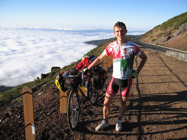
Canary island
photos


TRAVELOGUES:
2009 Canarian islands
by bicycle
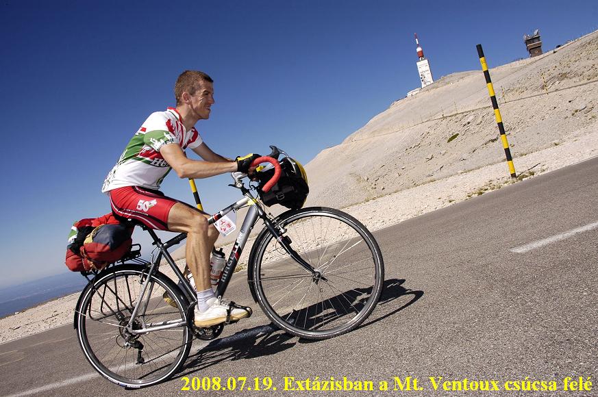
2008 aLPS - by bicycle
2007: Raid Pyreneen
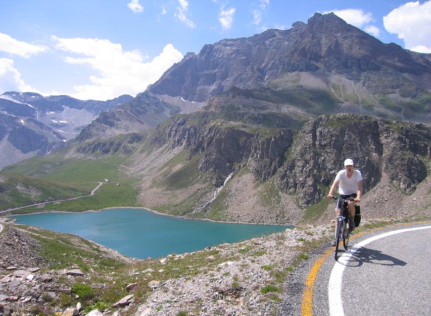
2006 Alps by bicycle
2005 Alps by bicycle
2004 - French Alps, cols
2003 - Croatia
Montenegro
2002 - Greece
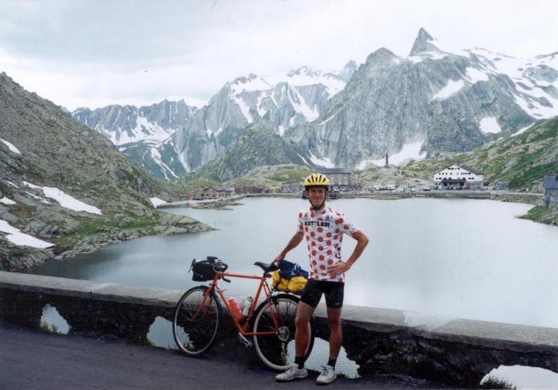
2001 - Switzerland
2000 - Dolomites
Lake Garda
Venice>
1999 - Tátra
1998 - Tátra
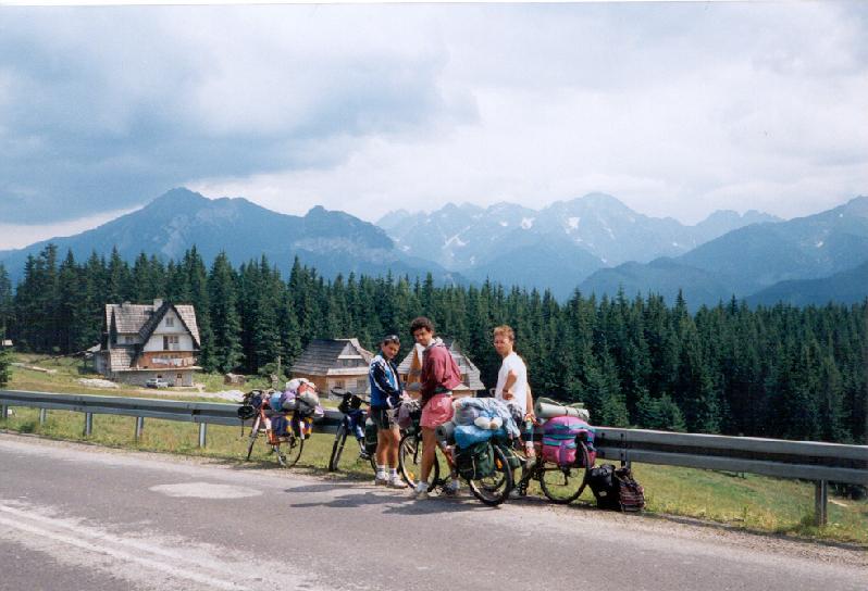
1997 - Tátra
1995 - Tátra
1993 - Tátra

|
5th July, 2009: Bourg d’Oisans – Grenoble –TRAIN – Genf = cycled: 77,27 km + 120 m heightdiff.
After a partly enough sleeping I prepared for the day calmly without any hurry, I used the web for a half-hour (the meteo didn’t forecast good weather for Tirol and Bayern), then at noon I started cycling to Grenoble from where I travelled by train to Geneve. I had to change the train at Aix les Bains where I had 2 hours so I visited the shore of the lake. In Geneve I bought a map about the city in vain, because as I found the camping that was closer then the other, I had to realize that the camping didn’t already exsist. I had to search the other camping by the shore of the lake. I set up my tent after sunset at half past 9 pm.
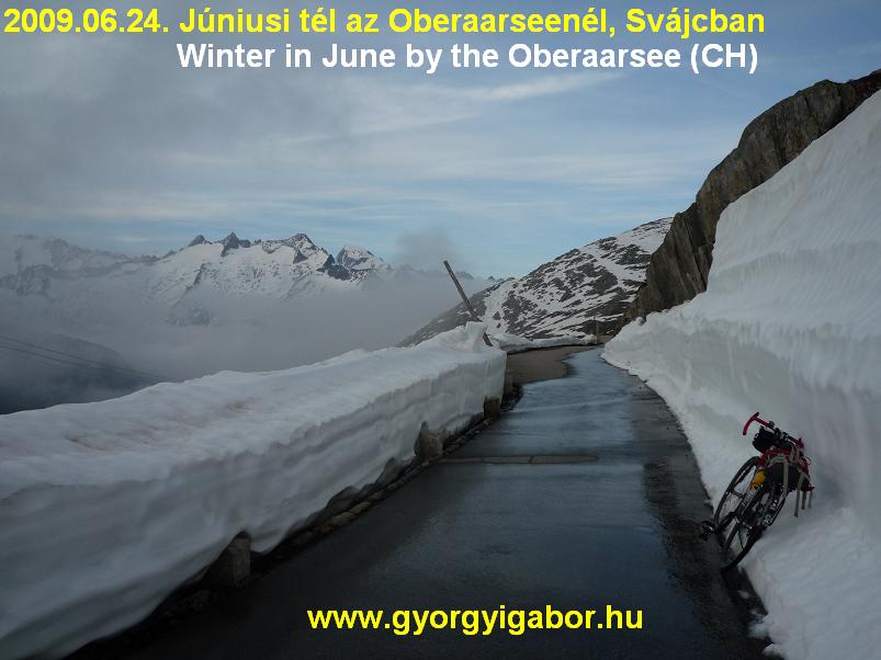
6th July, 2009 – 16th day: Geneve – TRAIN – Bregenz, from there by bicycle – Schwarzach - Hittisau – Riderbergpass (1420 m) – Obersdorf = 80,52 km + 1255 m heightdiff.
By the train station I didn’t have cash for buying breakfast and had no time for queuing by an ATM for cash-withdrawal so I had to get ont he train without any food. The morning didn’t start well. The weather outside wasn’t good, people were in long clothes outside. After St Gallen the next stop was St Margarethen (next to the german border) where it was little bit raining. Next time in Bregenz I cycled a little along the shore of the Bodensee (lake) and in the little streets of the town, where I got a quick shower. After the rain I left Bregenz and turned to the mountains, I cycled towards Oberstdorf, Germany the center of the the BIG (a href=”www.challenge-big.eu” target=”_blank”>www.challenge-big.eu) meeting. After 1-2 hours the weather front went away and I cycled in sunny, beautiful weather on friendly landscape between or next to 1200-1800m high mountains. I arrived at Oberstdorf after climbing te sometimes 14% steep, 1420m high Riderbergpass. In Obersdorf Gabor’s sms helped me where to cycle, then as Daniel overcame me by a car told me where to find the acomodation. We finished the day with a little bit speach and good bye drink and the hungarian guys told me their experiences. For the next day a few climbs waited for us and then everybody went home.
7th July, 2009 : Obersdorf – Nebelhorn to 1333 m – Obersdorf – Sonthofen – Allgauer Berghof (1341 m)– Obersdorf – Sonthofen – Oberjoch – Reutte – Berwang = 134,47 km + 2395 m heightdiff.
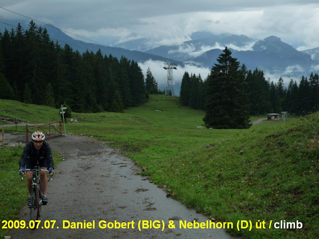 We woke up for cloudy and humid weather. As I cycled down to the town it started to rain. Because we couldn’t meet with Gabor and the other guys, I decided to wait a bit because of the rain. While I searched the right way to the paved ascent of Nebelhorn I met with Daniel Gobert, the president of the BIG with whom we started the terrible climb together. While he pushed the pedals sitting in the saddle, I preferred standing up above the saddle: it’s better for my knees. I could spin my pedals quicker then him with my lighter gears, so the climb wasn’t so hard for me than for Daniel. So I could take a few photos about him ? The 17-20% steep road went up in a forest and gave us views to the cloudy landscape very rarely. Fortunetely it wasn’t raining during or climb. Before we came out from the forest I overtook an other member who used lighter gears then me: I think his lowest gear should be 22, mine is 28. As the asfalt ended at the height of 1333m, just above a house we stopped.
The unpaved road went up and up but it was so steep that I saw as the guy who I overtook should stop cycling and push his bike along him. I don’t like climbs and I dan’t call cycling when we has to push our bikes. I prefer long and normally steep climbs, like Ventoux, Mortirolo, maximum the brutal Monte Zoncolan.
Because of the rain and while I has no car to sit in if it’s raining I traveleld to Sonthofen in a train,
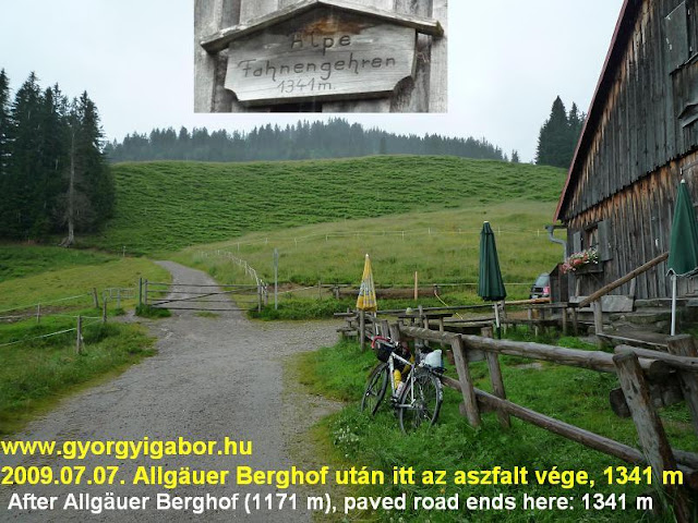 then I cycled the next BIG listed summit, the Allgauer Berghof. In the lost it was written to be 1171 m. I cycled the ascent in raincoat and –trousers; sometimes it was 15% steep, but elsewhere normally. Although there was a warning table (maybe it is a private road and others aren’t let go above) I cycled further up because the paved road went on upwards. And above the Allgauer Berghof the road was steeper: 14-18% steep for 300m long. The road was harder above where the BIG members finished climbing it a few days ago: I decided to notice the need of change the BIG’s highest point when I arrive to Hungary. From the cablecar station the road went further, but that wasn’t already extremely steep. The paved road ended at a 1341m high situated house, where I turned back. I was proud of my achievement that in such a terrible weather I cycled to the end of the paved road and experienced it’s true hardness.
As the climb lasted only 1 hour long I noticed that with such a climbs people can collect 6-7-10 BIGs in a day (more if they travel by car between them), but in for example South Switzerland an average trained cyclist can collect only 2 in a day with 1500-1800m heightdfference. So the BIG’s values are not the same. For me the more hour long climbs has true values.
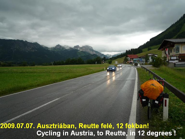
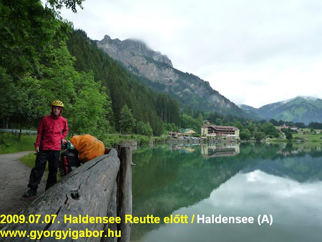
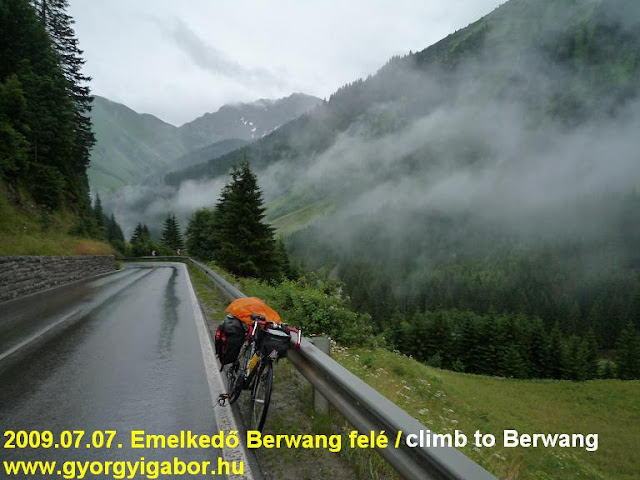
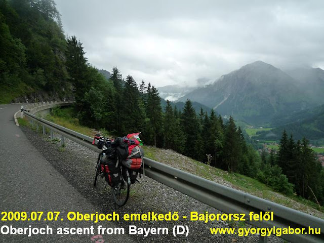 After coming down I enjoyed the warm air in a bakery as I ate delicious cakes, then I bought some food in a warm shop. I cycled back to Oberstdorf where I preparred my bike and packs for cycling to Austria sometimes in rain. I could cycle another 2 hours without any rain, but on the climb of the light Oberjoch (border pass to Austria) it started raining again. That was the highest village of Germany. In Austria I cycled one hour in hopeless weather: it was 11-12 degrees Celsius. I enjoyed again a warm shop as I bough food for the evening and the following morning. Fortunately the rain stopped for a while (Reutte), but I finished the day cycling 1-2 hours in rain again. In the evening it seemed that the rain won’t go away so I planned to sleep in a house. Fortunately at a stop by a tourism box along the road I found prospects there so I got detailled informations about the accomodtaions in Berwang, the 4th BIG climb of this day. That wasn’t a hard climb again, maybe only the last 2kms was steep enough. It was good to sleep in a warm house and dry my clothes.
I was proud of that in such a bad weather I could cycle onto 4 BIG listed climbs without travelling by car between them : usually I did this way as I cycled that day.
8th July, 2009. Berwang – Ehrwalder Alm (1510 m)– Fernpass – Imst – Landeck – Fiss – Möseralm (1812 m) – Landeck = 144,5 km + 2115 m heightdifference
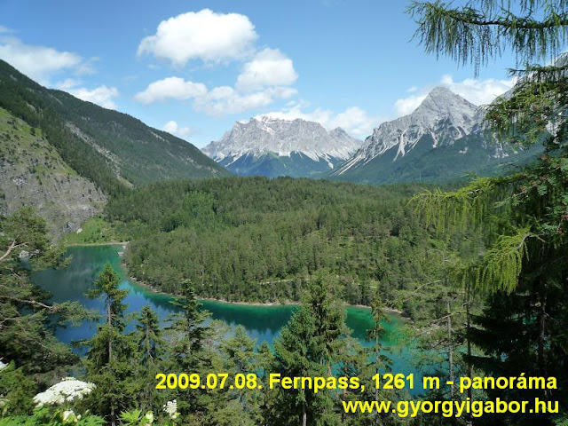
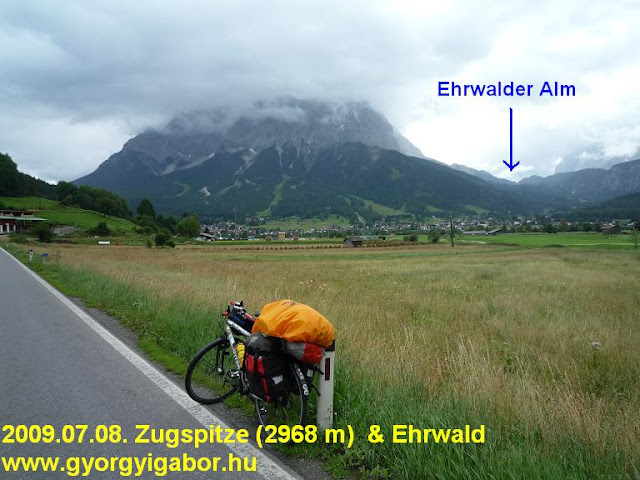 I woke up for a partly cloudy weather, but in the first half of the day it rained a few times. I told to it angrily: „-Aren’t you able to finish raining ?” In Ehrwald the Sun was already shining. I hide my heavy packs in the almost empty parking place of the cablecar station, and as I pushed the pedals on the 14-16% steep climb – to Ehrwalder Alm - in the sunny, somestimes lightly showered forest I knew that it couldn’t be done with 25kg pack on my back of the bicycle. The climb was 14-16% steep continuously for 4kms long. As I arrived at the 1510m high situated tourist house I could enjoy the clear sunny panorama to the mountains. There were interesting animals, similar to cows there: maybe buffalos. After a quick rain again the variable weather went away (for this day), and I ascended to the 1210 m high Fernpass enjoying the sunshine.
I wasn’t surprised by the wonderful view to blue-green lake and the Zugspitze, the highest peak of Germany.
 On the descent I went down to Imst, where I could use internet free in the tourist office: I choose from the BIG listed climbs: which to climb that evening and maybe next day if the weather remain bad and I decided not to cycle a test tour on the route of the Ötztaler radmarathon.
I bicycled on a bicyclepath to Landeck along the Inn river, and after setting up my tent I left Landeck only at 7 pm to cycle the BIG listed climb, Fiss which foot was 15kms from Landeck.
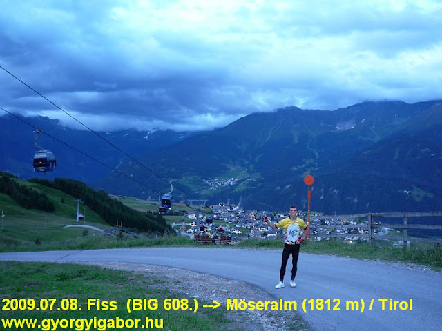 Fiss was an other climb which top was only the ca 1450m high situated village, but I had informations that paved road goes further up. I succeeded finding it and – as it was by Allgauer Berghof – the upper part of the climb was harder than the lower. To Fiss it was 9% steep, but after it the narrow road – to the 1812m high situated Möseralm – was average 11%, but few times 14% steep. I reached Möseralm almost in dark, so I had to be careful downwards.
Since then the top of this BIG climb was also actualised; now it is 1812 m ?
Thursday, 9th July, 2009. Landeck – TRAIN - Ötztal bahnhof – Sölden
Because of the weather foreact that forecasted rainy or partly riny day for Friday previous evening I decided and planned that I won’t do the Ötztaler radmarathon (bicyclemarathon) test tour. In the morning I had a phonecall with my parents: they told me the weather seemed not to be so bad, so I changed my plan change ?: I would face with the not truely summer weather and would attend this test tour. With this decision I renounced cycling up to Kaunertal or another BIG climbs, but I was (after 2,5 weeks of cycling in the Alps) motivated to try and convince to myself that I could do the Ötztaler bicyclemarathon and with foccussing onto that (maybe in 2010) I can do that inside the timelimit. I wanted to try how I could do it from the start to the end.
In the morning I cycled to the train station because of the schedule, then purchased food, washed my clothes. Because of the next hard day (ca. 228 kms + 5200 m heightdifference and without a marathon feeling so on my own) I preferred travelling by train that 38kms to Ötztal bahnhof station from where I had to cycle 38kms and 600m heightdifference up to Sölden, where I had reserved accomodation and is the startpoint of the Ötztaler radmarathon.
In the afternoon I surfed on the internet for 1,5 hours long, and finished the day with eating pasta in a restaurant which was open to midnight. At midnight a meteo-webcam shoed that it was 1-2 degrees Celsius on a peak just above 2600m. I had to carry warm clothes with me on the following day.
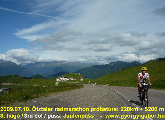
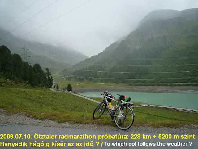
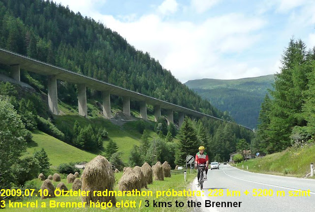
Friday, 10th July, 2009: ÖTZTALER RADMARATHON trial tour: Sölden – Öetz – Kühtai – Innsbruck – Brenner – Jaufenpass – Timmelsjoch – Sölden = 228 kms + 5203 m heightdiff.
I had bad night: I needed minimum 1 – 1.5 hours to fall asleep well. Before it it was warm, I felt tense, etc. I almost cancelled the tour. My clock rang at 6:20 am. As I didn’t feel me „knocked out”, after the breakfast with a coffee I decided to go. I was pushing the pedals to Oetz on watery, or wet road between partly cloudy mountains with small pieces of clouds, fog. Sometimes I saw the sky between the clouds. Climbing the first pass, Kühtai (2017 m) I could see that from West the clouds were breaking, but on the ascent the weather became worse: sometimes I could see my breath and 3kms before the saddle I cycled in rain, with determination in my mind.
That was a wise decision not to spare with clothes: I had raintrousers, raincoat and leggings. I came out under the rain by Kematen. In Innsbruck I turned South, to ascend the next Col, the 1374m high Brennerpass. I had fortune, because with feeling backwind and hearing music in my ears I could push the pedals with a good speed, and I was happy when the Sun came out 10kms before the top. I went on cycling in summer weather. It seemed it is a typical Ötzi weather: good for testing myself.
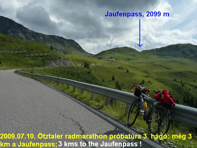
 After purchasing some food at Brenner I ate the banana, Powerbar and others during descending. From the end of Sterzing I could start the climb of Jaufenpass (2099 m) in short bicycleclothes on me. In 2006 on this col I reached the top in 90minutes, but then I was fresh. Now after the morning I had 138kms and 2088m heightdifference in my legs I tried to repeat this with the help of the spinning music. Rarely I stopped for a few photos, but on the middle section of the climb I didn’t stop for 600 m. On the last 3 panoramic kms I took more photos and videos.
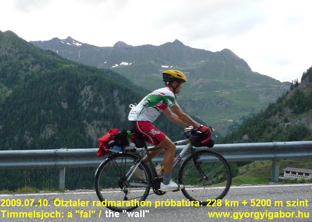
Because the timelimit is at St Leonhard after the sunny descent, which was rich in potholes, I made me slower and not to hurry so much: I climbed the road to the Timmelsjoch / Passo Rombo (2474 m) that way that I could enjoy it. In St Leonhard I had 15 minutes to buy the food that I thought I need, then I sat onto a bench and ate delicious cake, Powerbar, etc.
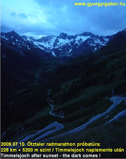
 I left the village at 6:30 pm to climb Passo Rombo with its more than 1800m heightdifference. For this distance the organisers calculate maximum 4 hours to do. My normal speed on ascents is 700-750 meters up / an hour, so it seemed that with 30 minutes rest I could reach the top in 3.5 hours. On the starting kilometers I felt the headwind yet, but fortunatelly that lasted only for a few kilometers, later the trees or the mountain sheltered me. Halfway was the point where I had to change my short clothes for warmer and I used the time for eating a little bit. The sun went down ca. at this time: I had ca. 750 meters ascending yet.
Although the upper section of the road is closed after 8 pm, but a barrier isn’t a problem for a cyclist. The upper 6kms I cycled in serious greyness and on the last – light – kilometer it was so cold that I didn’t stopped for clother changing only because of that I needed only 2-3 minutes to reach it. It was so cold that I after putting on the raintrousers, jacket, cap, leggings, I had to put on my spare socks onto my hands. I controlled the data at home: it was 3 degrees Celsius on Passo Rombo.
I left the village at 6:30 pm to climb Passo Rombo with its more than 1800m heightdifference. For this distance the organisers calculate maximum 4 hours to do. My normal speed on ascents is 700-750 meters up / an hour, so it seemed that with 30 minutes rest I could reach the top in 3.5 hours. On the starting kilometers I felt the headwind yet, but fortunatelly that lasted only for a few kilometers, later the trees or the mountain sheltered me. Halfway was the point where I had to change my short clothes for warmer and I used the time for eating a little bit. The sun went down ca. at this time: I had ca. 750 meters ascending yet.
Although the upper section of the road is closed after 8 pm, but a barrier isn’t a problem for a cyclist. The upper 6kms I cycled in serious greyness and on the last – light – kilometer it was so cold that I didn’t stopped for clother changing only because of that I needed only 2-3 minutes to reach it. It was so cold that I after putting on the raintrousers, jacket, cap, leggings, I had to put on my spare socks onto my hands. I controlled the data at home: it was 3 degrees Celsius on Passo Rombo.
 On the descent there is a ca. 2 kms long ascent with 150m heightdifference, but the half of it I really enjoyed in such a cold night. I arrived at the house at 11 pm. Although I was happy, I didn’t shouted into the air because of the laste time, but I was proud of myself. Without any problem and wave I cycled the route of the bicyclemarathon in good shape and in good form with good legs. Thinking about the time I needed, without shopping (food), having rest for long times, stopping too often and sometimes with the speed of the peloton I think I would be able to do it in the given time with a touring bike too. Because of the timelimit at St Leonhard it’s not a simple task, but it can be done. As the slogan of the Ötztaler bicyclemarathon says: „I have a dream!”
Saturday, 11th July, 2009: Sölden – Ötztal bahnhof – TRAIN – Vienna, then to Budapest
After sleeping enough I cycled down to ÖTztaler train station from where I cycled to Vienna, where I had excited moments with changing the trains. My train was late, but the other to Budapest waited it for my fortune. First I didn’t know that, but after 1-2 minutes I asked if I can enter it without a ticket to the border and I could do. With this fortune I could arrive at Budapest just on that day. ?
Summary:
During the 21days of the bicycletour (3 of them were mainly trevelling.) I cycled 2335,1 kms while I climbed 47060 m heightdifference: another new record. After the 9-13 Hors categorie ascent that I cycled in the previous years in a tour, in 2009 I climbed 12-13 Hors Cat. ascent.
The statistics (I can summarize it only after the tour and didn’t influence the planned route):
- During that 3 weeks I cycled 15 times above 2000m (the total is at the end of the year: 132 and 101 is differenct ascent.)
- Totally I cycled more than 1500m heightdifference 10 times (contains the pair of Telegraphe – Galibier), one of them was with packed bicycle.
- Althugh this are only 1-1 days but I broke 2 personal records:
- My new heightdifference record for a day with heavy packs is: 3156 m
- My new heightdifference record for a day without heavy packs is: 5316 m
(Both can be changed in the following years.)
And at last in this year I reached the 1.000.000 climbed meter heightdifference since I started bicycling abroad 16 years ago.

| Day |
Route |
Trip distance |
Time |
Average |
height
diff. |
kcal = |
| Start: |
Előzmény, szervezés, útvonal-terv, indormáció-gyűjtemény
BEVEZETÉS ! |
| Júni 21. |
Bergamo helyi tekerés – VONAT – Varese – Campo dei Fiori (1217 m)- Rancio – Passo Cuvignone – Cittiglio - Verbania – kemping
Túraleírásért kattints ide !
|
79,30 km |
5:06:12 (79,30) |
15,5 |
1788 m |
2960 kcal |
| Júni 22. |
kemping – Stresa – Mottarone (1421 m) - Stresa
- kemping – Domodossola – Gabi (Svájc) – AUTÓ – Visp
Túraleírásért kattints ide !
|
128,2 km |
7:57:45
(123,66) |
15,5 |
2524 m |
4684 kcal |
| Júni 23. |
Visp – Tatschalp (2240 m) – Saas fee – Mattmarksee (2197 m) - Visp
Túraleírásért kattints ide !
|
130,16 km |
7:08:10 (126,1) |
17,7 |
3065 m |
4226 kcal |
| Júni 24. |
Visp – VONAT - Susten -Alpe Galm (2231 m) - Susten – VONAT - Oberwald - Grimselpass – Oberaarsee (2400 m) – Oberwald – VONAT - Visp
Túraleírásért kattints ide !
|
79,6 km |
5:33:42 |
14,4 |
2757 m |
3345 kcal |
| Júni 25. |
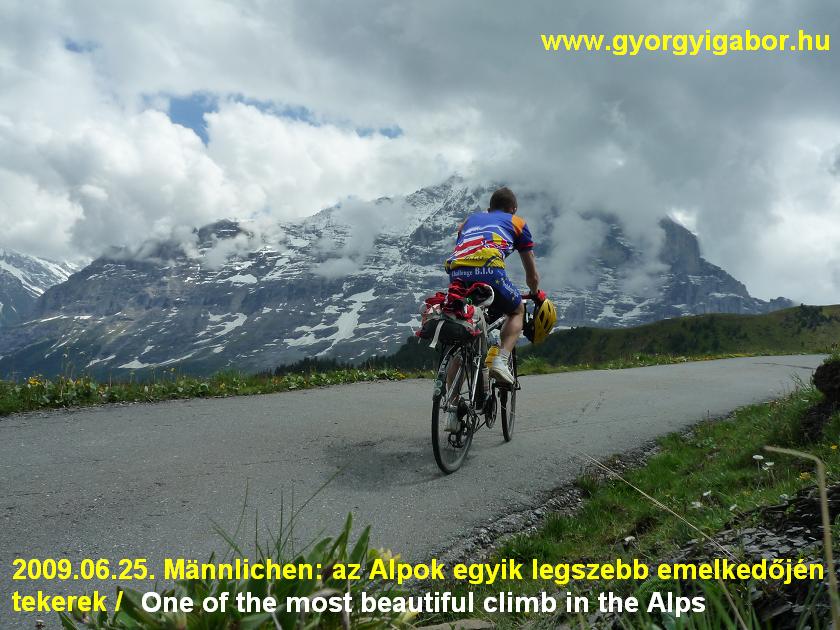
Visp – VONAT – Interlaken – Grindelwald – Mannlichen (2229 m) – Grindelwald – Interlaken – VONAT - Visp – Sierre – Bramois
Túraleírásért kattints ide !
|
123,3 km |
5:53:47 |
24,5 |
1902 m |
3262 kcal |
| Júni 26. |
Bramois – Sierre – Lac Moiry (2249 m) – Sierre – Bramois – Thyon – Bramois
Túraleírásért kattints ide !
|
141,64 km |
8:30:03
(138,17) |
16,4 |
3672 m |
4405 kcal |
| Júni. 27. |
Bramois – Barrage de la Gr Dixence (2141 m) - Arolla (2006 m) – Bramois
|
112,06 km |
6:55:42
(109,41) |
15,8 |
2817 m |
3257 kcal |
| Júni. 28. |
Bramois Sion – Pas de Morgins (1367 m) - Chatel – Colle Bassachaux (1778 m) – Les Lindarets – Montriond
|
87,2 km |
??
(83,3 km) |
? |
1700 m |
3141 kcal |
| Júni. 29. |
Montriond – Col d’Encrenaz – Col de Ramaz (1619 m) - Taninges – Cluses – Col de la Colombiere (1618 m) - Le Grand Bornand – Col de la Croix-Fry (1467 m) – Col des Aravis (1498 m) - Flumet - Albertville
|
139,05 km |
9:19:34 (139,05) |
14,9 |
3151 m |
4289 kcal |
| Júni. 30. |
Albertville – VONAT – Moutiers – Brides le Bains – Val Thorens (2340 m) – Brides les Bains
| 102,23 km |
6:05:36 (93,23) |
15,3 |
2251 m |
2577 kcal |
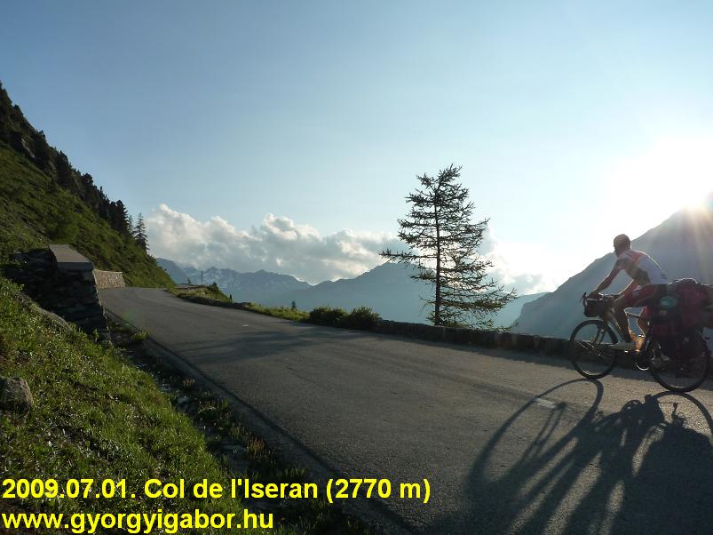
| Júli. 1. |
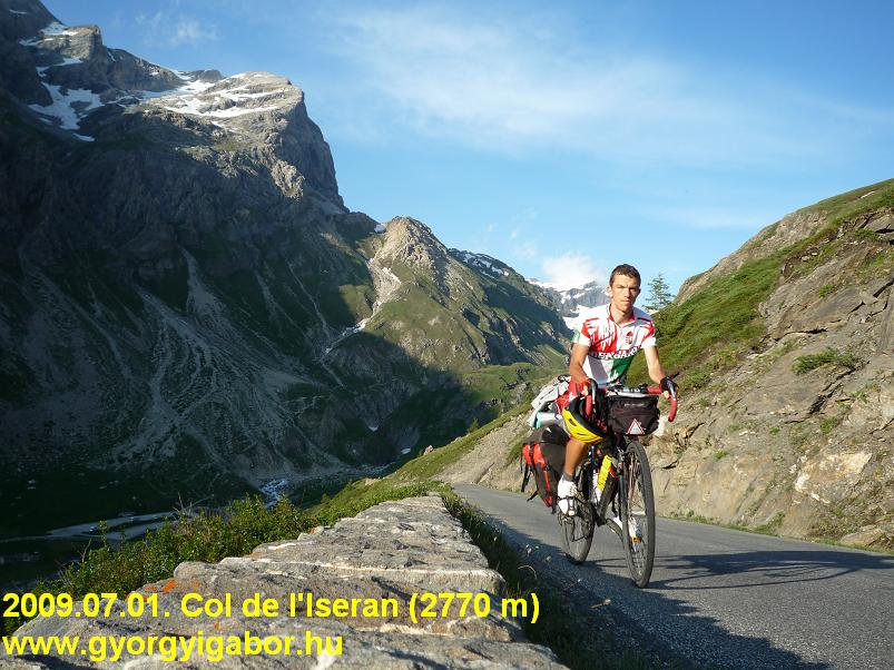
Brides les Bains – Bourg St Maurice – Col d’Iseran (2770 m) - Lanslevillard
|
119,45 km |
8:24:19 (119,45) |
14,2 |
2640 m |
3701 kcal |
| Júli. 2. |
Lanslevillard – Modane – VONAT – Grenoble – Bourd d’Oisans
|
86,6 km |
4:27:09 (86,6) |
19,4 |
596 m |
1524 kcal |
| Júli. 3. |
Bourd d’Oisans – Alpe d’Huez (1860 m) – Bourg d’Oisans
|
30,7 km |
2:03:54 |
14,8 |
1071 m |
1062 kcal |
| Júli. 4. |
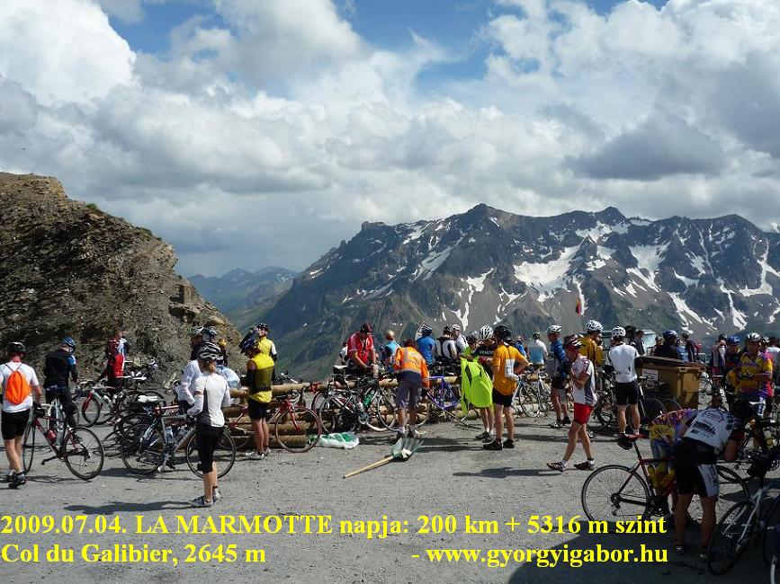
LA MARMOTTE : Bourg d’Oisans – Col du Glandon (1924 m) - St Jean – Col du telegraphe – Col du Galibier (2645 m) – Bourg d’Oisans – Alpe d’Huez (1860 m) – Bourg d’Oisans – 400m fel és vissza
|
200,12 km |
10:32:22 (199,8) |
19,0 |
5316 m |
6060 kcal |
| Júli. 5. |
Bourd d’Oisans – Grenoble – VONAT – Genf - kemping
|
77,27 km |
- |
- |
120 m |
- kcal |
| Júli. 6. |
Genf – VONAT – Bregenz – Hittisau - Riderbergpass (1420 m) - Obersdorf
|
80,52 km |
4:11:57
(66,19 km) |
15,7 |
1255 m |
2000 kcal |
| Júli. 7. |
Obersdorf – Nebelhorn (aszfalt vége) – Obersdorf – Allgauer berghof – Obersdorf – Oberjoch – Berwang (AU)
|
134,47 km |
7:50:39 (127,57) |
16,2 |
2395 m |
3623 kcal |
| Júli. 8. |
Berwang – Lehrmoos – Ehrwalder alm legelő (1530 m) – Fernpass (1216 m) – Imst – Landeck – Fiss / Möseralm (1812 m) - Landeck
|
144,5 km |
7:38:38 (139,8) |
18,3 |
2115 m |
3211 kcal |
| Júli. 9. |
Landeck – VONAT - Ötztal bahnhof - Sölden
|
56,48 km |
2:26:00 (39) |
16,0 |
677 m |
982 kcal |
| Júli. 10. |
ÖTZTALER RADMARATHON próbatúra: Sölden – Oetz – Kühtai (2017 m) - Innsbruck – Brennerpass (1374 m) – Sterzing – Jaufenpass (2099 m) - St Leonhard – Timmelsjoch (2474 m) - Sölden
Túraleírásért kattints ide !
|
228,2 km |
12:01:31 |
19,0 |
5203 m |
6622 kcal |
| Júli. 10. |
Sölden – Ötztal Bahnhof – VONAT – Bécs – VONAT - Budapest
|
47,78 km |
1:21:54 (37,7) |
27,9 |
35 m |
- kcal |
| ÖSSZ.: |
- |
2335,13 km |
idő
(.. km) |
.. km/ó |
47060 m |
64931 kcal (19 napra)
átlag= 3417 kcal/nap |
|

 www.gyorgyigabor.hu